Well, I have some good news.
I got an old map of Huntsville today and it turns out that the abandoned rails and crossing were part of the rail line that went through Redstone Arsenal (I'm just going to call it the "Command Rail Line"). I hope to be able to go out and investigate those places soon.
Tracks out of service
Moderators: freebrickproductions, mlgillson, TommyBNSF, Raco_GS
-
freebrickproductions

- Posts: 8524
- Joined: Thu Jun 07, 2012 11:12 am
- Location: Huntsville, AL
- Contact:
Re: Tracks out of service
They/Them for me, please.
Click here if you want to submit crossing photos to the site!
Avatar by runesprite on Twitter.
Click here if you want to submit crossing photos to the site!
Avatar by runesprite on Twitter.
-
freebrickproductions
- Posts: 8524
- Joined: Thu Jun 07, 2012 11:12 am
- Location: Huntsville, AL
- Contact:
Re: Tracks out of service
Richmond, VA
It appears to be an abandoned spur:
https://maps.google.com/maps?hl=en&ll=3 ... 1,,0,14.96
This section was turned into part of the Virginia Capital Trail, while this other section remains untouched.
Remains of a roundhouse.
This line ends a few hundred feet before this crossing but it appears that it once went past here too.
It appears that the line ends at this crossing too.
Found another one:
https://maps.google.com/maps?hl=en&ll=3 ... ,7.13&z=20
https://maps.google.com/maps?hl=en&ll=3 ... 0,8.3&z=20
https://maps.google.com/maps?hl=en&ll=3 ... -1.11&z=20
A cantilever probably once stood here.
They/Them for me, please.
Click here if you want to submit crossing photos to the site!
Avatar by runesprite on Twitter.
Click here if you want to submit crossing photos to the site!
Avatar by runesprite on Twitter.

Re: Tracks out of service
I've found an oddity while following a hardly-used line in the Los Angeles/Anaheim area. On this abandoned spur, there is one signal that is equipped with LEDs and a WCH e-bell. The other signal uses old 8-inch incandescent lights and a WRRS mechanical bell. I'm guessing that this crossing received it's upgrade shortly before being abandoned. A bit of a waste of money don't you think? 
-
freebrickproductions
- Posts: 8524
- Joined: Thu Jun 07, 2012 11:12 am
- Location: Huntsville, AL
- Contact:
Re: Tracks out of service
It is possible that before the line was abandoned, the old signal was taken out by a car so they installed a new one in it's place.Nimhster wrote:I've found an oddity while following a hardly-used line in the Los Angeles/Anaheim area. On this abandoned spur, there is one signal that is equipped with LEDs and a WCH e-bell. The other signal uses old 8-inch incandescent lights and a WRRS mechanical bell. I'm guessing that this crossing received it's upgrade shortly before being abandoned. A bit of a waste of money don't you think?
They/Them for me, please.
Click here if you want to submit crossing photos to the site!
Avatar by runesprite on Twitter.
Click here if you want to submit crossing photos to the site!
Avatar by runesprite on Twitter.

Re: Tracks out of service
Tracks used to go through here until 1980
https://maps.google.com/?ll=48.957299,- ... 8,,0,-0.08
https://maps.google.com/?ll=48.957299,- ... 8,,0,-0.08
Railfanning since December 28, 2009!

Re: Tracks out of service
It looks to me like that side of the street received some recent renovations... based on the exposed brick along the curb there. It's possible they decided to upgrade that signal at the same time? But I do also agree that it is possible the old signal could have got mowed down and destroyed, so they replaced it with the newer parts.Nimhster wrote:I've found an oddity while following a hardly-used line in the Los Angeles/Anaheim area. On this abandoned spur, there is one signal that is equipped with LEDs and a WCH e-bell. The other signal uses old 8-inch incandescent lights and a WRRS mechanical bell. I'm guessing that this crossing received it's upgrade shortly before being abandoned. A bit of a waste of money don't you think?
-
freebrickproductions
- Posts: 8524
- Joined: Thu Jun 07, 2012 11:12 am
- Location: Huntsville, AL
- Contact:
Re: Tracks out of service
I know I have posted this crossing before, but I still have no idea what this line is or was.
15th Ave. SW, Huntsville, AL. Near Milton Frank Stadium
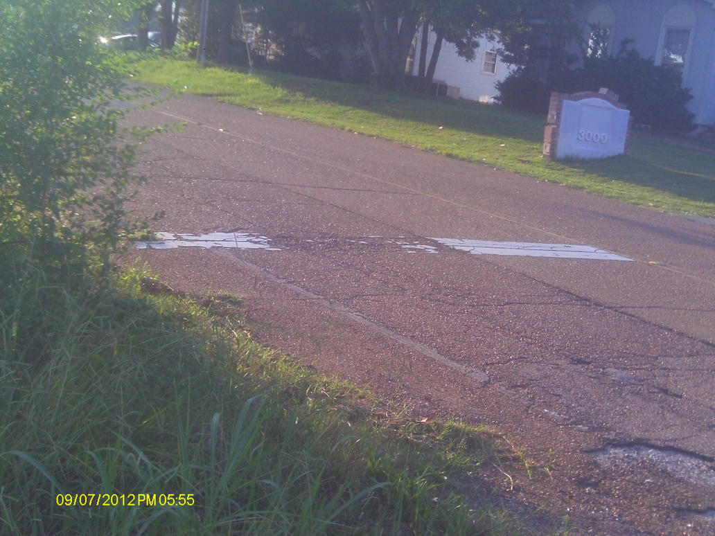
Facing north.
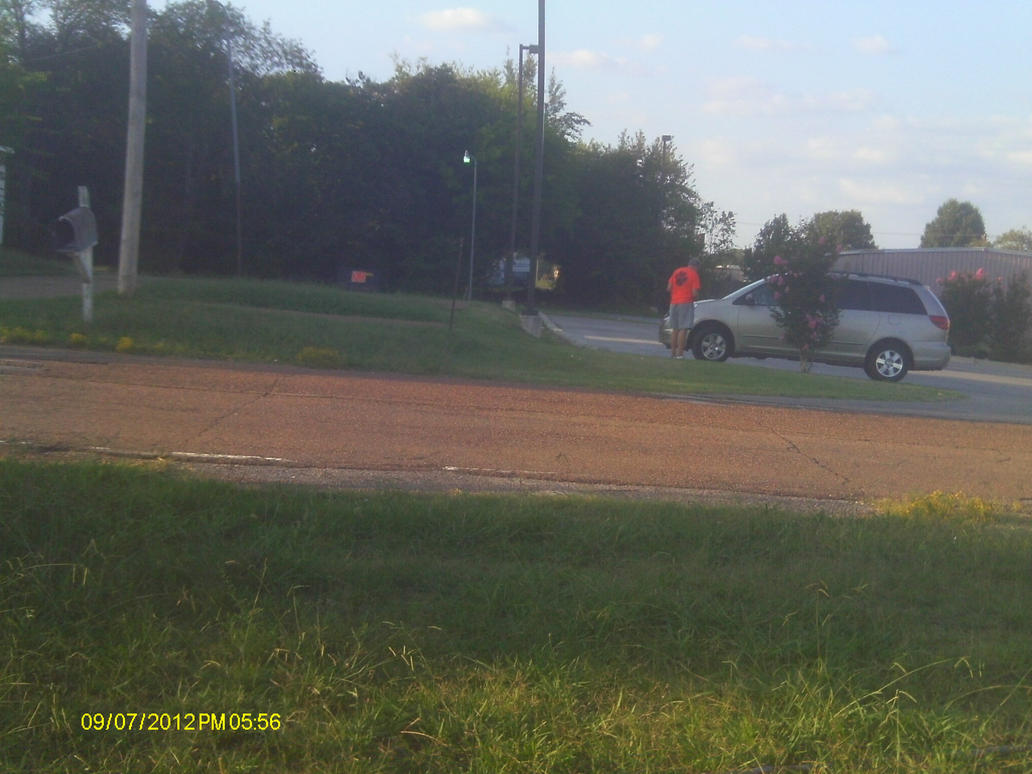
Facing south.
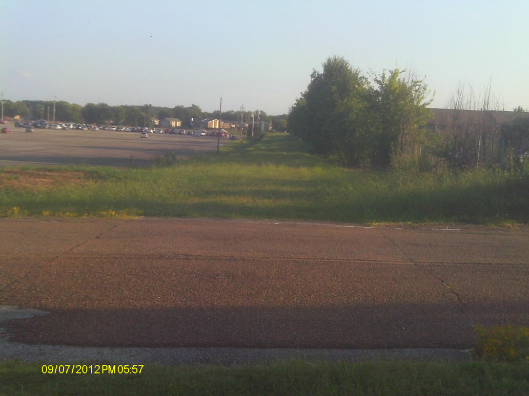
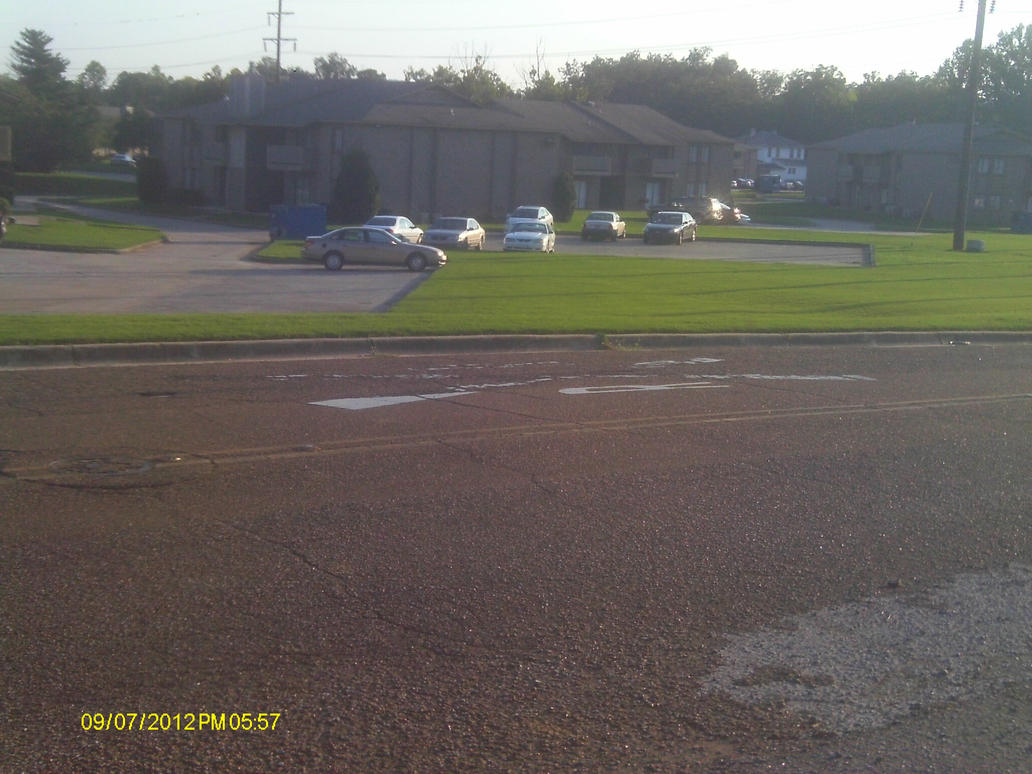
Same with this stretch of rail going across a creek.
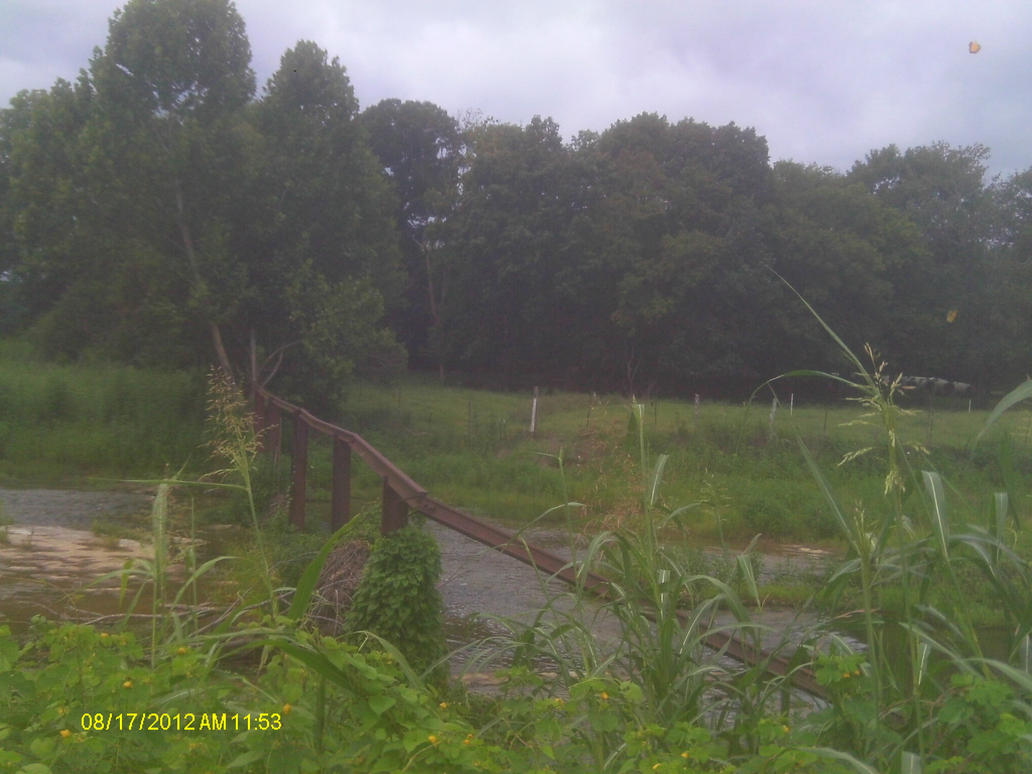
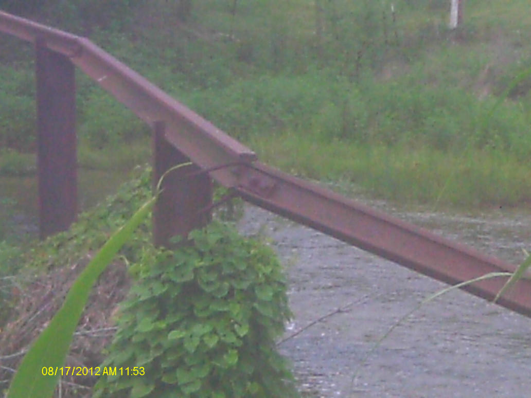
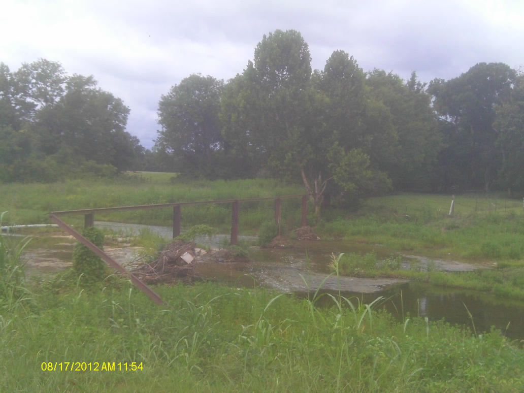
I also have pictures of an abandoned crossing on Redstone Arsenal.
15th Ave. SW, Huntsville, AL. Near Milton Frank Stadium
Facing north.
Facing south.
Same with this stretch of rail going across a creek.
I also have pictures of an abandoned crossing on Redstone Arsenal.
They/Them for me, please.
Click here if you want to submit crossing photos to the site!
Avatar by runesprite on Twitter.
Click here if you want to submit crossing photos to the site!
Avatar by runesprite on Twitter.
-
freebrickproductions
- Posts: 8524
- Joined: Thu Jun 07, 2012 11:12 am
- Location: Huntsville, AL
- Contact:
Re: Tracks out of service
Here's one in Norfolk, VA:
https://maps.google.com/maps?q=Norfolk, ... 9,,0,18.09
https://maps.google.com/maps?q=Norfolk, ... 9,,0,12.79
https://maps.google.com/maps?q=Norfolk, ... 27,,0,0.42
https://maps.google.com/maps?q=Norfolk, ... 89,,0,8.86
Abandoned crossing signal:
https://maps.google.com/maps?q=Norfolk, ... 09,,0,3.65
With a relay case on the other side of the street:
https://maps.google.com/maps?q=Norfolk, ... 03,,1,2.42
Here's another line:
https://maps.google.com/maps?q=Norfolk, ... 25,,0,8.59
Overgrown crossbuck:
https://maps.google.com/maps?q=Norfolk, ... 65,,0,4.57
https://maps.google.com/maps?q=Norfolk, ... 64,,0,9.23
They/Them for me, please.
Click here if you want to submit crossing photos to the site!
Avatar by runesprite on Twitter.
Click here if you want to submit crossing photos to the site!
Avatar by runesprite on Twitter.
Re: Tracks out of service
I was starting to think this shortly after I posted it.freebrickproductions wrote:It is possible that before the line was abandoned, the old signal was taken out by a car so they installed a new one in it's place.

-
freebrickproductions
- Posts: 8524
- Joined: Thu Jun 07, 2012 11:12 am
- Location: Huntsville, AL
- Contact:
Re: Tracks out of service
Appears to have once been a spur.
https://maps.google.com/maps?hl=en&ll=2 ... 91,,0,4.19
https://maps.google.com/maps?hl=en&ll=2 ... 91,,0,4.19
They/Them for me, please.
Click here if you want to submit crossing photos to the site!
Avatar by runesprite on Twitter.
Click here if you want to submit crossing photos to the site!
Avatar by runesprite on Twitter.