While looking around Tasmania, i stumbled across this out of service line that was used by TasRail until i believe abandoned the line in June 2014 when they relocated the freight terminal there. The crossings have all been stripped of the lights, the bells and crossbucks remain however.
The start of the line shows nothing but a pole and two signs saying "RAILWAY CROSSING NOT IN USE" but i don't see any signals, i wonder if this crossing was passive?
https://www.google.co.uk/maps/@-42.8800 ... 6656?hl=en
Crossbuck crossing
2009
https://www.google.co.uk/maps/@-42.8766 ... 6656?hl=en
Today
https://www.google.co.uk/maps/@-42.8766 ... 6656?hl=en
Pedestrian crossing that only had a diamond sign saying RAILWAY CROSSING.
https://www.google.co.uk/maps/@-42.8653 ... 6656?hl=en
Quite a strange crossing setup.
https://www.google.co.uk/maps/@-42.8559 ... 6656?hl=en
2015 shows all lights removed with the WCH bell replaced with a WCH E-Bell. It looks like a bell only crossing now!
https://www.google.co.uk/maps/@-42.8560 ... 6656?hl=en
Another setup showing Westinghouse 12x20 inch lights and presumably a WCH/WRRS mechanical bell, one of the signal bases is also painted yellow.
https://www.google.co.uk/maps/@-42.8539 ... 6656?hl=en
Same fate: crossing stripped down but crossbucks left and bell replaced with WCH E-bell.
https://www.google.co.uk/maps/@-42.8539 ... 6656?hl=en
A WCH E-Bell was already on this crossing in November 2009, it wasn't there in November 2007 though.
https://www.google.co.uk/maps/@-42.8477 ... 6656?hl=en
https://www.google.co.uk/maps/@-42.8477 ... 1664?hl=en
This crossing still has a surviving pair of Westinghouse 12x20 inch lights!
https://www.google.co.uk/maps/@-42.8451 ... 6656?hl=en
WCH E-Bell on a crossing in November 2007, i wonder if its gen 1 or gen 2?
https://www.google.co.uk/maps/@-42.8428 ... 1664?hl=en
Westinghouse LEDS?
https://www.google.co.uk/maps/@-42.8395 ... 6656?hl=en
Odd setup.
https://www.google.co.uk/maps/@-42.8351 ... 6656?hl=en
These lights are too big!
https://www.google.co.uk/maps/@-42.8328 ... 6656?hl=en
Rather strange to see ungated signals at the entrance to a construction yard.
https://www.google.co.uk/maps/@-42.8308 ... 6656?hl=en
Old school bases.
https://www.google.co.uk/maps/@-42.8285 ... 6656?hl=en
These bases seem rather long...
https://www.google.co.uk/maps/@-42.8259 ... 6656?hl=en
More old school yellow bases.
https://www.google.co.uk/maps/@-42.8147 ... 6656?hl=en
Crossbuck crossing still standing as of 2015.
https://www.google.co.uk/maps/@-42.8091 ... 6656?hl=en
No bell.
https://www.google.co.uk/maps/@-42.8002 ... 6656?hl=en
This crossing still has a WCH mechanical bell!
https://www.google.co.uk/maps/@-42.7920 ... 6656?hl=en
This crossing remains untouched!
https://www.google.co.uk/maps/@-42.7489 ... 6656?hl=en
This crossing is also untouched!
https://www.google.co.uk/maps/@-42.7379 ... 6656?hl=en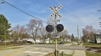


