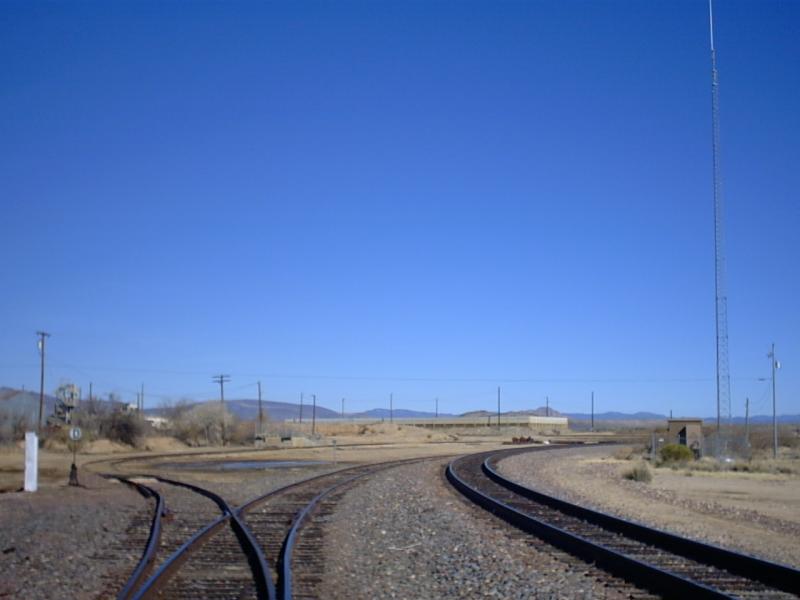
I found out from the FRA that there was one crossing out here that I haven't found yet. It said it was a crossbuck crossing back from 2000, but I ventured out here to see if it was still the same. This crossing is about 17 miles west of the Kirkland crossing, and about 17 miles North of the Date Creek crossing. The town has a population less than 50 people.
|
1 |
2 |
||||
|
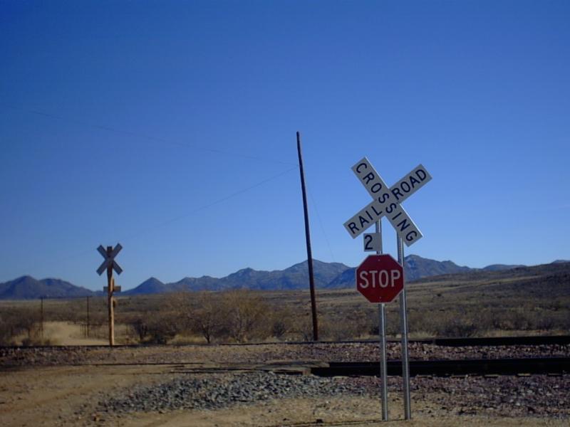
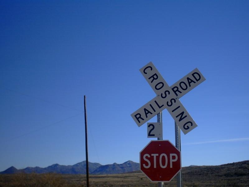
Check this poor warning sign. The wrong placement of the crossbuck, the "2" instead of 2-tracks, and the double posts don't do wonders for this crossing. |
This one is the same original one that existed. You can see the "2" from the other sign from this angle. |
|
3 |
||
|
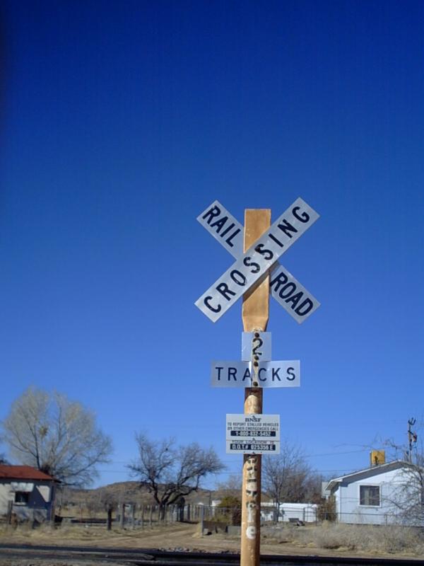
A Close-up of the other sign. |
|
4 |
5 |
6 |
7 |
||||||||
|
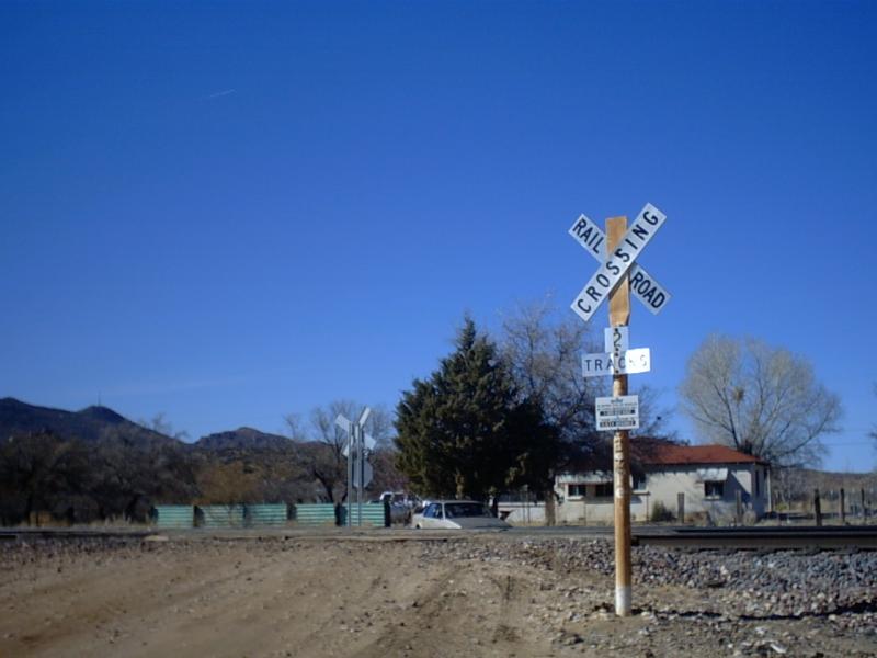
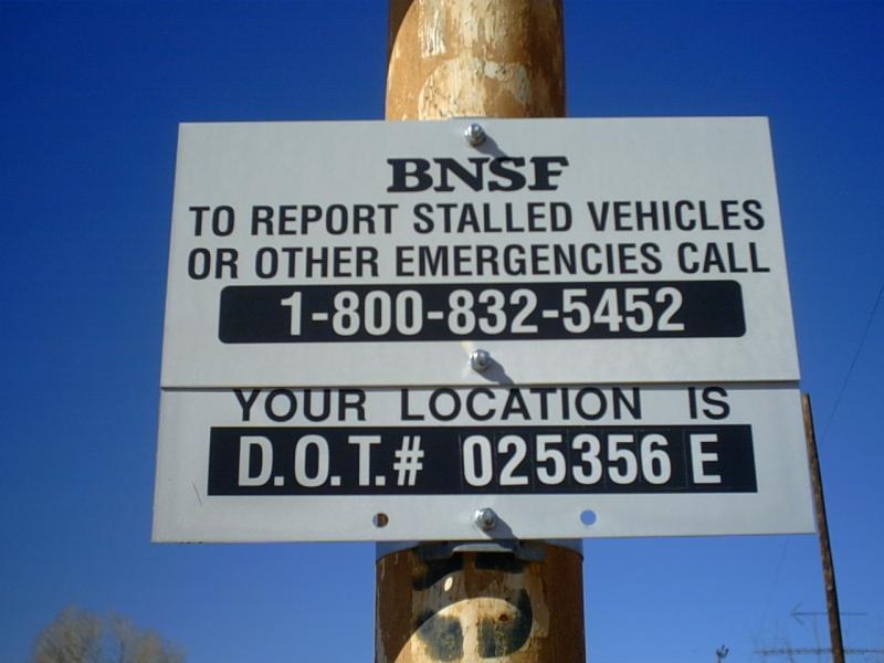
This road had no identification. I found out this was THE road, when I compared the DOT # from picture 4 with the FRA. Pictures 5 and 6 show views of the crossing Picture 5 is looking North, and picture 6 is looking South. Picture 7 shows another picture from the rush job on the other sign. I think the "2" is used on railroads for milepost numbers. The crossing in itself isn't that good either. It's wooden, and really warped. All 7 pictures were taken February 6, 2004. |
|||||||||||
March 6, 2005 update...
|
8 |
9 |
10 |
||||||
|
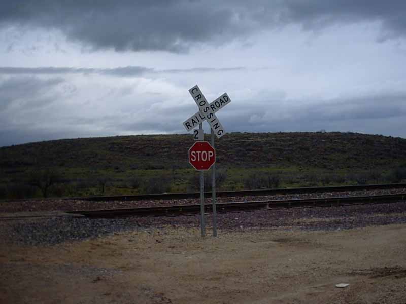
This crossing has changed surprisingly changed. Picture 8 shows the same old wrong way crossbuck, which hasn't changed. Pictures 9 and 10 show the other sign has been replaced by a new crossbuck, new post, a new stop sign, but the 2 tracks sign and the crossing ID sign were carried forward from the old sign. |
||||||||
|
11 |
12 |
||||
|
You can see the old wooden post that was chopped down. |
Here's a rear look to the "2". |