 |
|
|
|
|
|
|
|
|
Page created by: [TrainmanKight]
All pictures were taken July 16, 2010.
|
1 1423x800 161
KB
|
2 |
3 1423x800 437
KB
|
|
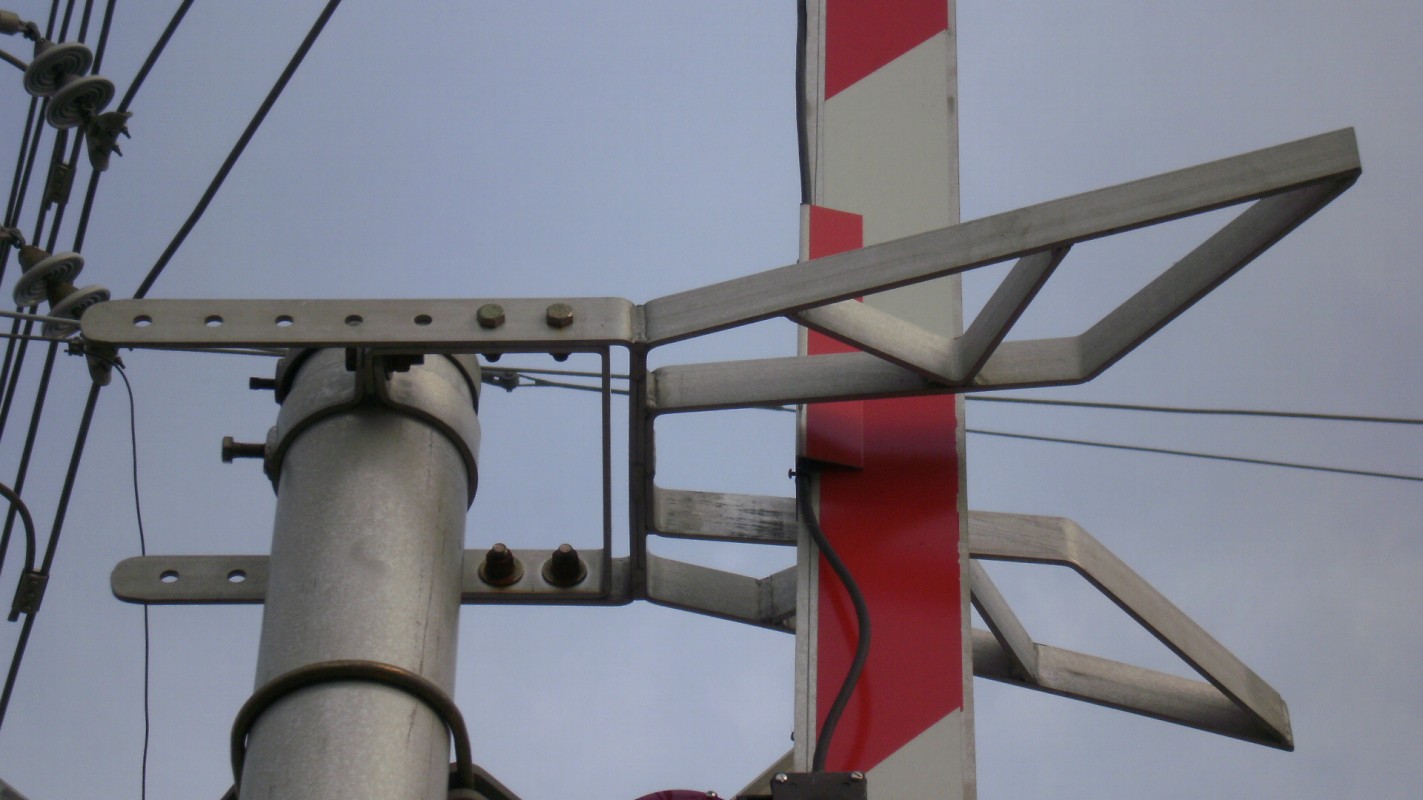
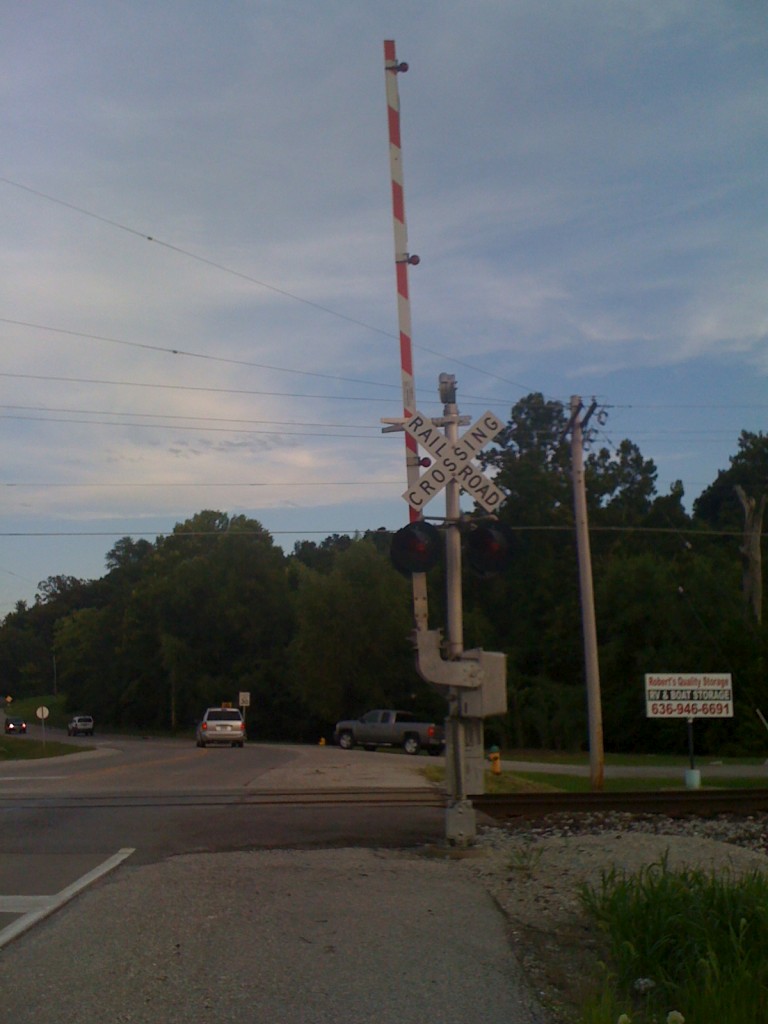
Overview of the crossing. Both signals have
mostly Safetran equipment on them.
|
||


|
4 1423x800 148
KB
|
5 1423x800 174
KB
|
6 1423x800 167
KB
|


|
7 1423x800 163
KB
|
8 |
9 |
|
Both gates have gate guard springs from
General Signals as seen in pictures 4-7.
|
||


|
10 1423x800 148
KB
|
11 1423x800 161
KB
|
12 1423x800 131
KB
|
|
Note the red take holding the gate wire to
the gate.
|
||


|
13 1423x800 213
KB
|
14 |
15 |


Note: Picture 14 was taken with an iphone 3.
|
16 1423x800 139
KB
|
17 1423x800 162
KB
|
18 1423x800 249
KB
|


|
19 1423x800 209
KB
|
20 1423x800 314
KB
|
21 |


|
22 1423x800 179
KB
|
23 1423x800 162
KB
|
24 |
|
From the other side of the crossing, we find
nearly the same setup.
|
||


|
25 |
26 1423x800 218
KB
|
27 1423x800 150
KB
|


Note: Picture 25 was taken with the iphone 3.
|
28 |
29 1423x800 134
KB
|
30 1423x800 168
KB
|
|
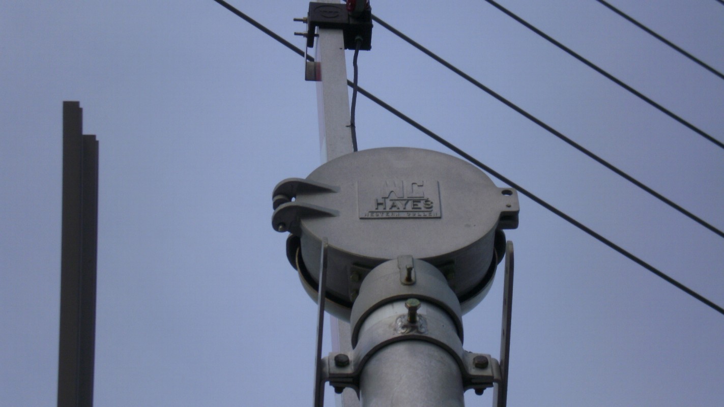
Here's the exception. There is a WCH mechanical bell here, which actually replaced a GS type 1 electronic bell!
The GS type 1 rang from startup to when the gates lowered, and when the gates rose to deactivation. It's unknown what the WCH bell does, but it's assumed to do the same thing. |
||


|
31 |
32 |
33 1423x800 188
KB
|
|
A sunset view of the crossing.
|
More info, read below...
|
Side view of the crossing.
|


Note: Pictures 31 and 32 were taken with the iphone 3.
|
34 1423x800 165
KB
|
35 1423x800 143
KB
|
36 1423x800 295
KB
|
|
More scenery around the crossing.
|
||


|
37 1423x800 170
KB
|
38 1423x800 146
KB
|
39 1423x800 113
KB
|
|
The DOT number for this crossing.
|
Track view.
|
A hawk is landing on top of the telephone
pole.
|


|
40 1423x800 118
KB
|
41 1423x800 146
KB
|
42 |
|
The hawk looks at the camera.
|
A view of the old Elm Point Rd.
|
Another track view.
|


|
A 1280x960 1.35 MB *PNG FORMAT* |
B 1280x960 1.05 MB *PNG FORMAT* |
C 1280x960 1.51 MB *PNG FORMAT* |
|
These are views of the current, and old crossings taken on Google Earth. Picture A shows the older Elm Point Rd. crossing taken back in March 1999, with the track in red, and the road in black in picture A. Picture B is the same as picture A, except without extra line color. Picture C shows the current Zumbehl Rd. crossing.
According to Google Earth, the Elm Point Rd. crossing was closed, and the Zumbehl Rd. crossing was created sometime between 1999 to 2002. The FRA only made its first inventory report for this crossing in 2007. |
||


As seen above this crossing has been relocated, back in the early '80s traffic wasn't a big deal. Since this was open country, the crossing back then had lights only and one m-bell, as the city began to grow and traffic became heavier more wrecks happened. At Elm Point Rd. there were over a dozen crossing wrecks, resulting in a few fatalities, because of those wrecks this crossing was rated the worst in the state back in the '90s. It was at that point when the city of St. Charles and state of Missouri planed and began funding for a new road crossing, it wasn't until after 2000 that the road was finished, with what you see above.