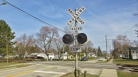
I was talking about the two tracks in particular! I even said that the crossing is active.ZachL wrote:Doesn't look active to me?ToledoRailfan wrote:Out of service tracks with an active crossing on them in Grand Island, Nebraska.
https://www.google.com/maps/@40.9272555 ... 6656?hl=en
https://www.google.com/maps/@40.9272555 ... 6656?hl=en
https://www.google.com/maps/@40.9272555 ... 6656?hl=en
https://www.google.com/maps/@40.9272555 ... 6656?hl=en
Tracks out of service
Moderators: freebrickproductions, mlgillson, PlyingKibbles89, Raco_GS, Hopen111, TommyBNSF
-
ToledoRailfan
- No Longer Associated With The Forum
- Posts: 3315
- kuchnie-na-wymiar.wroclaw.pl
- Joined: Sun Jul 21, 2013 2:38 pm
Re: Tracks out of service

Re: Tracks out of service
Grade would have been a better word to use...ToledoRailfan wrote:I was talking about the two tracks in particular! I even said that the crossing is active.ZachL wrote:Doesn't look active to me?ToledoRailfan wrote:Out of service tracks with an active crossing on them in Grand Island, Nebraska.
https://www.google.com/maps/@40.9272555 ... 6656?hl=en
https://www.google.com/maps/@40.9272555 ... 6656?hl=en
https://www.google.com/maps/@40.9272555 ... 6656?hl=en
https://www.google.com/maps/@40.9272555 ... 6656?hl=en
Crossing pictures from Plant City, FL are finally here! viewtopic.php?f=13&t=2538

-
freebrickproductions

- Posts: 9337
- Joined: Thu Jun 07, 2012 11:12 am
- Location: Huntsville, AL
- Contact:
Re: Tracks out of service
Amazing that that old CoG signal has managed to survive! He used to have a friend on the other side with a split crossbuck:LARDLOGO wrote:https://goo.gl/maps/cEMEJnrHK5t
https://www.google.com/maps/@32.4133461 ... 1664?hl=en
They/Them for me, please.
Click here if you want to submit crossing photos to the site!
Avatar by runesprite on Twitter.
Click here if you want to submit crossing photos to the site!
Avatar by runesprite on Twitter.
-
ToledoRailfan
- No Longer Associated With The Forum
- Posts: 3315
- Joined: Sun Jul 21, 2013 2:38 pm
Re: Tracks out of service
freebrickproductions wrote:LARDLOGO wrote:He used to have a friend on the other side with a split crossbuck:
-
freebrickproductions
- Posts: 9337
- Joined: Thu Jun 07, 2012 11:12 am
- Location: Huntsville, AL
- Contact:
Re: Tracks out of service
This is actually what I thought of when I typed that:ToledoRailfan wrote:freebrickproductions wrote:LARDLOGO wrote:He used to have a friend on the other side with a split crossbuck:
They/Them for me, please.
Click here if you want to submit crossing photos to the site!
Avatar by runesprite on Twitter.
Click here if you want to submit crossing photos to the site!
Avatar by runesprite on Twitter.
-
ToledoRailfan
- No Longer Associated With The Forum
- Posts: 3315
- Joined: Sun Jul 21, 2013 2:38 pm
Re: Tracks out of service
Here is an abandoned railroad bridge and the former right of way of a railroad in the Osage Nation in Oklahoma.
https://www.google.com/maps/@36.9220627 ... !1e3?hl=en
https://www.google.com/maps/@36.917284, ... !1e3?hl=en
https://www.google.com/maps/@36.8712469 ... !1e3?hl=en
https://www.google.com/maps/@36.8637651 ... !1e3?hl=en
I came across this line while browsing Google Maps and Streetview of the Osage Nation. I came across it when I saw the symbols (don't know what else to call them) for railroad tracks, I went to streetview and I was confused as to why I couldn't find any, so I went to Google Earth view and I could clearly see where there was once a rail line.
https://www.google.com/maps/@36.8664581 ... .26z?hl=en
-
ToledoRailfan
- No Longer Associated With The Forum
- Posts: 3315
- Joined: Sun Jul 21, 2013 2:38 pm
Re: Tracks out of service
So I headed over to Abandoned Rails.com and I found this line which was part of a Railroad known as The Midland Valley Railroad. There is little to know information about this line on the site which makes me more interested! 
I went over to Wikipedia's article about this railroad and it has a significant amount of information, it doesn't have many sources but I think it kind of has a decent amount.
I went over to Wikipedia's article about this railroad and it has a significant amount of information, it doesn't have many sources but I think it kind of has a decent amount.
-
ToledoRailfan
- No Longer Associated With The Forum
- Posts: 3315
- Joined: Sun Jul 21, 2013 2:38 pm
Re: Tracks out of service
Here are some crossings on the B&O's Sandusky to Newark line. This line was filed for abandonment in 1975 and 1976 so it is crazy that these crossings are still there!  I'd love to see these in person and actually explore the line (obviously not on parts on NASA property).
https://www.google.com/maps/@41.3600525 ... !1e3?hl=en
https://www.google.com/maps/@41.3785833 ... !1e3?hl=en
Dang! There's still stretches of track! This is (was) part of a spur system for NASA.
https://www.google.com/maps/@41.3578055 ... !1e3?hl=en
https://www.google.com/maps/@41.3576966 ... !1e3?hl=en
https://www.google.com/maps/@41.3575137 ... !1e3?hl=en
https://www.google.com/maps/@41.3545612 ... !1e3?hl=en
I'm amazed at how much of the former right of way is still visible!
https://www.google.com/maps/@41.3501576 ... !1e3?hl=en
https://www.google.com/maps/@41.3413408 ... !1e3?hl=en
https://www.google.com/maps/@41.3598292 ... !1e3?hl=en
https://www.google.com/maps/@41.3702436 ... !1e3?hl=en
https://www.google.com/maps/@41.3767667 ... !1e3?hl=en
https://www.google.com/maps/@41.3842754 ... !1e3?hl=en
Here is a photograph of one of the crossings, not exactly sure where it is located.

http://picture.abandonedrails.com/piolgug8.jpg
https://www.google.com/maps/@41.3600525 ... !1e3?hl=en
https://www.google.com/maps/@41.3785833 ... !1e3?hl=en
Dang! There's still stretches of track! This is (was) part of a spur system for NASA.
https://www.google.com/maps/@41.3578055 ... !1e3?hl=en
https://www.google.com/maps/@41.3576966 ... !1e3?hl=en
https://www.google.com/maps/@41.3575137 ... !1e3?hl=en
https://www.google.com/maps/@41.3545612 ... !1e3?hl=en
I'm amazed at how much of the former right of way is still visible!
https://www.google.com/maps/@41.3501576 ... !1e3?hl=en
https://www.google.com/maps/@41.3413408 ... !1e3?hl=en
https://www.google.com/maps/@41.3598292 ... !1e3?hl=en
https://www.google.com/maps/@41.3702436 ... !1e3?hl=en
https://www.google.com/maps/@41.3767667 ... !1e3?hl=en
https://www.google.com/maps/@41.3842754 ... !1e3?hl=en
Here is a photograph of one of the crossings, not exactly sure where it is located.
http://picture.abandonedrails.com/piolgug8.jpg

Re: Tracks out of service
So what happens when you old train cars break free and try to go over a paved over crossing?
https://www.google.com/maps/@42.4927798 ... 312!8i6656
See below.
Note: There was nobody aboard the cars and luckily no cars on the road when these came barreling through, so no injuries.
https://www.google.com/maps/@42.4927798 ... 312!8i6656
See below.
Note: There was nobody aboard the cars and luckily no cars on the road when these came barreling through, so no injuries.
- 23471909_1842638479381487_8722997263047935999_n.jpg (86.61 KiB) Viewed 6587 times
- 23379880_1842638429381492_4584305657236026323_n.jpg (150.91 KiB) Viewed 6587 times
- 23472460_1842638416048160_989816349883639085_n.jpg (95.06 KiB) Viewed 6587 times
- 23435033_1842638389381496_3126975552634779994_n.jpg (93.15 KiB) Viewed 6587 times
- 23472086_1842638322714836_6366342586918351415_n.jpg (110.69 KiB) Viewed 6587 times
- 23319315_1842638319381503_5721445032447095307_n.jpg (86.76 KiB) Viewed 6587 times
- 23434874_1842638249381510_4695101282688554950_n.jpg (162.67 KiB) Viewed 6587 times
- 23379902_1842638179381517_8038498765486663384_n.jpg (139.91 KiB) Viewed 6587 times
- 23379867_1842638176048184_6577069997964288539_n.jpg (110.31 KiB) Viewed 6587 times
- 23434964_1842638169381518_7621256864582864922_n.jpg (158.81 KiB) Viewed 6587 times
- 23379886_1842638172714851_3525187175703289705_n.jpg (137.21 KiB) Viewed 6587 times