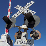
This is in Louisville, KY
https://goo.gl/maps/qQaZ4AFEben
Tracks out of service
Moderators: freebrickproductions, mlgillson, PlyingKibbles89, Raco_GS, Hopen111, TommyBNSF
-
LARDLOGO

- Posts: 844
- kuchnie-na-wymiar.wroclaw.pl
- Joined: Thu May 24, 2012 8:51 pm
- Location: Whatcom County, Washington
Re: Tracks out of service
Railfanning since December 28, 2009!

Re: Tracks out of service
Interesting...LARDLOGO wrote:This is in Louisville, KY
https://goo.gl/maps/qQaZ4AFEben
https://www.google.com/maps/@38.1962675 ... 312!8i6656
Crossing pictures from Plant City, FL are finally here! viewtopic.php?f=13&t=2538
-
NathanFromEngland

- Posts: 2377
- Joined: Sat Apr 29, 2017 3:52 pm
- Location: Merseyside
Re: Tracks out of service
I continued to look around, i found this crossbuck crossing, but since then it has been removed and the land on the right redeveloped.ZachL wrote:Interesting...LARDLOGO wrote:This is in Louisville, KY
https://goo.gl/maps/qQaZ4AFEben
https://www.google.com/maps/@38.1962675 ... 312!8i6656
https://www.google.com/maps/@38.1992957 ... 328!8i1664
...You can see where the grade was though, not a great resurfacing job if you ask me.
https://www.google.com/maps/@38.1993294 ... 312!8i6656
Possible trackage remains, but now redeveloped and long gone.
https://www.google.com/maps/@38.2001463 ... 328!8i1664
Refer to me as 'Nari' - He/She are my preferred pronouns
Re: Tracks out of service
When tracks are paved over like that, the fact that there's not completely solid asphalt right there doesn't help when it wears off over time.NathanFromEngland wrote:...You can see where the grade was though, not a great resurfacing job if you ask me.
https://www.google.com/maps/@38.1993294 ... 312!8i6656
Crossing pictures from Plant City, FL are finally here! viewtopic.php?f=13&t=2538
-
NathanFromEngland
- Posts: 2377
- Joined: Sat Apr 29, 2017 3:52 pm
- Location: Merseyside
Re: Tracks out of service
San Antonio, Texas.
https://www.google.com/maps/@29.3720276 ... 6656?hl=en
https://www.google.com/maps/@29.3720276 ... 6656?hl=en
Refer to me as 'Nari' - He/She are my preferred pronouns
-
freebrickproductions

- Posts: 9356
- Joined: Thu Jun 07, 2012 11:12 am
- Location: Huntsville, AL
- Contact:
Re: Tracks out of service
Not sure if this was posted before, but, here's an abandoned crossing in Vancouver, Canada:
https://www.google.com/maps/@49.2707544 ... 384!8i8192
Further up the line:
https://www.google.com/maps/@49.2692426 ... 312!8i6656
Looks like this was an electric commuter/light rail line, and this was a station?
https://www.google.com/maps/@49.2690173 ... 384!8i8192
A crossbuck crossing a bit further up the line:
https://www.google.com/maps/@49.2662239 ... 384!8i8192
Views looking down the tracks, also showing the small 8 inch transit lights facing the tracks here:
https://www.google.com/maps/@49.2660621 ... 384!8i8192
https://www.google.com/maps/@49.2660621 ... 384!8i8192
Continuing up the line:
https://www.google.com/maps/@49.2681754 ... 384!8i8192
A forgotten crossbuck:
https://www.google.com/maps/@49.2681932 ... 384!8i8192
The line disappears after that, but then it appears to connect into what's currently an active freight line.
They/Them for me, please.
Click here if you want to submit crossing photos to the site!
Avatar by runesprite on Twitter.
Click here if you want to submit crossing photos to the site!
Avatar by runesprite on Twitter.
Re: Tracks out of service
Nice abandoned traffic signal cantilevers as well:freebrickproductions wrote:Not sure if this was posted before, but, here's an abandoned crossing in Vancouver, Canada:
https://www.google.com/maps/@49.2707544 ... 384!8i8192
Further up the line:
https://www.google.com/maps/@49.2692426 ... 312!8i6656
Looks like this was an electric commuter/light rail line, and this was a station?
https://www.google.com/maps/@49.2690173 ... 384!8i8192
A crossbuck crossing a bit further up the line:
https://www.google.com/maps/@49.2662239 ... 384!8i8192
Views looking down the tracks, also showing the small 8 inch transit lights facing the tracks here:
https://www.google.com/maps/@49.2660621 ... 384!8i8192
https://www.google.com/maps/@49.2660621 ... 384!8i8192
Continuing up the line:
https://www.google.com/maps/@49.2681754 ... 384!8i8192
A forgotten crossbuck:
https://www.google.com/maps/@49.2681932 ... 384!8i8192
The line disappears after that, but then it appears to connect into what's currently an active freight line.
https://www.google.com/maps/@49.2681932 ... 384!8i8192
Crossing pictures from Plant City, FL are finally here! viewtopic.php?f=13&t=2538
-
MapsSurfer
- Posts: 154
- Joined: Fri Dec 16, 2016 4:26 pm
Re: Tracks out of service
This isn't a crossing, but I found the remains of an FEC abandoned spur near Hialeah.
https://www.google.com/maps/@25.8423454 ... 312!8i6656
https://www.google.com/maps/@25.8423454 ... 312!8i6656
Re: Tracks out of service
That's pretty neat! Wonder why they didn't cover the rest of the span up closer to the road.MapsSurfer wrote:This isn't a crossing, but I found the remains of an FEC abandoned spur near Hialeah.
https://www.google.com/maps/@25.8423454 ... 312!8i6656
Crossing pictures from Plant City, FL are finally here! viewtopic.php?f=13&t=2538
-
brett nc railfanner
- Posts: 591
- Joined: Sun Jun 14, 2015 8:50 am
- Location: San Diego, CA
Re: Tracks out of service
Oklahoma City, Oklahoma:
https://www.google.com/maps/@35.4641343 ... 312!8i6656
https://www.google.com/maps/@35.4689386 ... 312!8i6656
Midwest City, Oklahoma:
https://www.google.com/maps/@35.4573945 ... 312!8i6656
https://www.google.com/maps/@35.4556564 ... 312!8i6656
https://www.google.com/maps/@35.4538548 ... 328!8i1664
https://www.google.com/maps/@35.451551, ... 312!8i6656
https://www.google.com/maps/@35.4496011 ... 312!8i6656
https://www.google.com/maps/@35.436742, ... 328!8i1664
https://www.google.com/maps/@35.4351805 ... 312!8i6656
Here is a different line in Shawnee, Oklahoma:
https://www.google.com/maps/@35.3265186 ... 312!8i6656
https://www.google.com/maps/@35.3116813 ... 312!8i6656
https://www.google.com/maps/@35.3042444 ... 312!8i6656
https://www.google.com/maps/@35.3013981 ... 312!8i6656
https://www.google.com/maps/@35.2953548 ... 312!8i6656
https://www.google.com/maps/@35.2896531 ... 312!8i6656
https://www.google.com/maps/@35.2846504 ... 328!8i1664
Earlsboro, Oklahoma
https://www.google.com/maps/@35.2751633 ... 312!8i6656
https://www.google.com/maps/@35.2678977 ... 312!8i6656
Seminole, Oklahoma
https://www.google.com/maps/@35.2442534 ... 312!8i6656
https://www.google.com/maps/@35.2222946 ... 312!8i6656
https://www.google.com/maps/@35.2238883 ... 312!8i6656
Wewoka, Oklahoma
https://www.google.com/maps/@35.162224, ... 312!8i6656
https://www.google.com/maps/@35.1612706 ... 312!8i6656
https://www.google.com/maps/@35.1448966 ... 312!8i6656
Holdenville, Oklahoma
https://www.google.com/maps/@35.0868041 ... 312!8i6656
https://www.google.com/maps/@35.0860216 ... 312!8i6656
https://www.google.com/maps/@35.0834352 ... 312!8i6656
https://www.google.com/maps/@35.0826423 ... 312!8i6656
https://www.google.com/maps/@35.0818056 ... 312!8i6656
https://www.google.com/maps/@35.08092,- ... 312!8i6656
https://www.google.com/maps/@35.0793262 ... 312!8i6656
https://www.google.com/maps/@35.0776197 ... 312!8i6656
https://www.google.com/maps/@35.0722427 ... 312!8i6656
Calvin, Oklahoma
https://www.google.com/maps/@34.9700154 ... 312!8i6656
Stuart, Oklahoma
https://www.google.com/maps/@34.9039451 ... 328!8i1664
McAlester, Oklahoma
https://www.google.com/maps/@34.8870248 ... 312!8i6656
https://www.google.com/maps/@34.8869431 ... 312!8i6656
https://www.google.com/maps/@34.8986188 ... 312!8i6656
https://www.google.com/maps/@34.9023854 ... 312!8i6656
Line goes to being active after that crossing.
Last edited by brett nc railfanner on Tue Feb 26, 2019 7:12 pm, edited 2 times in total.