An abandoned railroad bridge in Roanoke Rapids, NC:
https://www.google.com/maps/@36.4736344 ... a=!3m1!1e3
Now removed signals in Edenton, NC:
https://www.google.com/maps/@36.069767, ... 328!8i1664
Going down the line:
https://www.google.com/maps/@36.0675032 ... 312!8i6656
https://www.google.com/maps/@36.0666545 ... 312!8i6656
Going up the line:
https://www.google.com/maps/@36.0718656 ... 312!8i6656
https://www.google.com/maps/@36.0730483 ... 328!8i1664
https://www.google.com/maps/@36.0750923 ... 312!8i6656
An abandoned spur on a removed line in Leland, NC:
https://www.google.com/maps/@34.2722487 ... 312!8i6656
Another abandoned railroad bridge in Castle Hayne, NC:
https://www.google.com/maps/place/Longl ... 77.8921008
Abandoned spur in Bennettsville, South Carolina:
https://www.google.com/maps/@34.6250201 ... 312!8i6656
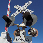
Abandoned signals in Mt Airy, NC:
https://www.google.com/maps/@36.5084267 ... 312!8i6656
Tracks out of service
Moderators: freebrickproductions, mlgillson, PlyingKibbles89, Raco_GS, Hopen111, TommyBNSF
-
brett nc railfanner
- Posts: 591
- kuchnie-na-wymiar.wroclaw.pl
- Joined: Sun Jun 14, 2015 8:50 am
- Location: San Diego, CA
-
brett nc railfanner
- Posts: 591
- Joined: Sun Jun 14, 2015 8:50 am
- Location: San Diego, CA
Re: Tracks out of service
Turns out the line has been abandoned since 2007, and someone is trying to revive the line.Ethan the Railfanner wrote: Tue Dec 03, 2019 11:52 pmI also noticed a rare "Do Not Climb" sign on the right cantilever. It seems like regardless, all crossing cantilevers are illegal to climb on unless you are a signal maintainer.freebrickproductions wrote: Tue Dec 03, 2019 4:23 pmLooking at past imagery, it appears that it sees occasional use, but it's mostly unused.brett nc railfanner wrote: Tue Dec 03, 2019 3:33 pm Unsure if this part is abandoned or not:
https://www.google.com/maps/@35.414102, ... 384!8i8192
And based on my logic, I'm actually certain that the crossing is now out of service.
https://m.thesnaponline.com/2019/01/31/ ... ize-badin/
-
NathanFromEngland

- Posts: 2377
- Joined: Sat Apr 29, 2017 3:52 pm
- Location: Merseyside
Re: Tracks out of service
Lynn Haven, Florida.
https://www.google.com/maps/@30.2428626 ... 328!8i1664
Signals removed by 2011, but seems rather strange (probably just me) to have cantilevers for a small residential street.
https://www.google.com/maps/@30.24287,- ... 312!8i6656
The next crossing over seems to have a pair of new-looking crossbucks.
https://www.google.com/maps/@30.2423212 ... 312!8i6656
The crossing to the east also had a crossbuck, by 2016 it had been removed.
https://www.google.com/maps/@30.2391908 ... 312!8i6656
Track views.
https://www.google.com/maps/@30.2391837 ... 312!8i6656
https://www.google.com/maps/@30.2391837 ... 312!8i6656
Next crossing had a pair of cantilever signals
https://www.google.com/maps/@30.237625, ... 328!8i1664
Another passive crossing.
https://www.google.com/maps/@30.2329915 ... 312!8i6656
The tracks are pretty visible to the east of the crossing.
https://www.google.com/maps/@30.2330208 ... 312!8i6656
This crossing had a RACO(?) setup in 2007.
https://www.google.com/maps/@30.231036, ... 328!8i1664
By 2011, the crossing had uniquely and unusually, downgraded to crossbuck protection.
https://www.google.com/maps/@30.231114, ... 312!8i6656
The whole crossing was removed by 2015. Tracks before the crossing are still visible to the right.
https://www.google.com/maps/@30.2311445 ... 312!8i6656
Some more trackside views.
https://www.google.com/maps/@30.2269048 ... 312!8i6656
https://www.google.com/maps/@30.2269048 ... 312!8i6656
Wooden crossbucks.
https://www.google.com/maps/@30.2240508 ... 312!8i6656
Quite an interesting view...
https://www.google.com/maps/@30.2185763 ... 312!8i6656
The ties are visible to the right (and i mean with the exposure)
https://www.google.com/maps/@30.2137946 ... 312!8i6656
Look's like the crossing was still there in 2015.
https://www.google.com/maps/@30.2141056 ... 312!8i6656
Signalized crossing that was downgraded to crossbucks by 2011, removed by 2015.
https://www.google.com/maps/@30.2114385 ... 328!8i1664
https://www.google.com/maps/@30.2114558 ... 312!8i6656
The line seems to enter a main line for what i assume is the BAYL, here is a crossing that crosses over a highway. The motion blur, seems rather satisfying for me.
https://www.google.com/maps/@30.2056167 ... 328!8i1664
The whole crossing was removed by 2011, and that is where the line ends.
Additionally, here is an inverted(?) stop on red signal sign!
https://www.google.com/maps/@30.2056194 ... 328!8i1664
Refer to me as 'Nari' - He/She are my preferred pronouns
-
freebrickproductions

- Posts: 9356
- Joined: Thu Jun 07, 2012 11:12 am
- Location: Huntsville, AL
- Contact:
Re: Tracks out of service
Yep, that's some kind of former branch line the BAYL had.
They/Them for me, please.
Click here if you want to submit crossing photos to the site!
Avatar by runesprite on Twitter.
Click here if you want to submit crossing photos to the site!
Avatar by runesprite on Twitter.
-
KCMO Railfan

- Posts: 360
- Joined: Tue Aug 13, 2019 10:53 am
- Location: Kansas city Missouri
Re: Tracks out of service
Found these classic signals In Reeds, Missouri.
https://www.google.com/maps/@37.1161291 ... authuser=0
for some reason the exempt sign on this signal is facing backwards away from the roadway.
https://www.google.com/maps/@37.1163032 ... authuser=0
Rare Cat eye crossbuck and us&s teardrop bell at this crossing too!
https://www.google.com/maps/@37.1164376 ... authuser=0
This line is on an abandoned BNSF line. Satellite views show that these signals are still there.
Proud owner of 7 mechanical bells along with a pair of safetran 12x20 lights and a 8 inch light. Been a fan of trains since I was little. Main place I railfan on, The Sedalia Sub.
-
brett nc railfanner
- Posts: 591
- Joined: Sun Jun 14, 2015 8:50 am
- Location: San Diego, CA
Re: Tracks out of service
Abandoned tracks in Ely, Nevada:
https://www.google.com/maps/@39.3840331 ... 312!8i6656
More from the old line:
https://www.google.com/maps/@40.266341, ... 312!8i6656
https://www.google.com/maps/@41.0942347 ... 328!8i1664
https://www.google.com/maps/@39.3628996 ... 312!8i6656
https://www.google.com/maps/@39.3840331 ... 312!8i6656
More from the old line:
https://www.google.com/maps/@40.266341, ... 312!8i6656
https://www.google.com/maps/@41.0942347 ... 328!8i1664
https://www.google.com/maps/@39.3628996 ... 312!8i6656
-
freebrickproductions
- Posts: 9356
- Joined: Thu Jun 07, 2012 11:12 am
- Location: Huntsville, AL
- Contact:
Re: Tracks out of service
Huh:brett nc railfanner wrote: Sat Dec 14, 2019 9:41 pm https://www.google.com/maps/@40.266341, ... 312!8i6656
https://www.google.com/maps/@40.2664452 ... 312!8i6656
Looks like the older gateless signals at that crossing were just dumped next to the relay case:brett nc railfanner wrote: Sat Dec 14, 2019 9:41 pm https://www.google.com/maps/@39.3628996 ... 312!8i6656
https://www.google.com/maps/@39.362674, ... 312!8i6656
Wonder what railroad that was?
EDIT: Doing some research reveals that this was part of the Nevada Northern Railway. This part of the line has been OOS since 1983, but a project that would've revived the line in the late-2000s stalled out, which is probably why those gateless signals were replaced.
They/Them for me, please.
Click here if you want to submit crossing photos to the site!
Avatar by runesprite on Twitter.
Click here if you want to submit crossing photos to the site!
Avatar by runesprite on Twitter.
-
NathanFromEngland
- Posts: 2377
- Joined: Sat Apr 29, 2017 3:52 pm
- Location: Merseyside
Re: Tracks out of service
In 2007, there was an abandoned hopper here.freebrickproductions wrote: Sun Dec 15, 2019 2:50 amHuh:brett nc railfanner wrote: Sat Dec 14, 2019 9:41 pm https://www.google.com/maps/@40.266341, ... 312!8i6656
https://www.google.com/maps/@40.2664452 ... 312!8i6656
Looks like the older gateless signals at that crossing were just dumped next to the relay case:brett nc railfanner wrote: Sat Dec 14, 2019 9:41 pm https://www.google.com/maps/@39.3628996 ... 312!8i6656
https://www.google.com/maps/@39.362674, ... 312!8i6656
Wonder what railroad that was?
EDIT: Doing some research reveals that this was part of the Nevada Northern Railway. This part of the line has been OOS since 1983, but a project that would've revived the line in the late-2000s stalled out, which is probably why those gateless signals were replaced.
https://www.google.com/maps/@39.3628142 ... 328!8i1664
In November 2008, you can see that the signals were removed and obviously dumped in this location.
https://www.google.com/maps/@39.3626478 ... 328!8i1664
By May 2009, the new signals were installed, but the bell was a WCH mechanical bell, the other signal had no bell.
https://www.google.com/maps/@39.3627958 ... 328!8i1664
https://www.google.com/maps/@39.3619134 ... 328!8i1664
Fast forward 9 years later, the signals were modified/replaced with GS E-Bells, LED Lights, and double sided crossbucks.
https://www.google.com/maps/@39.3619394 ... 312!8i6656
https://www.google.com/maps/@39.3628996 ... 312!8i6656
Refer to me as 'Nari' - He/She are my preferred pronouns
-
brett nc railfanner
- Posts: 591
- Joined: Sun Jun 14, 2015 8:50 am
- Location: San Diego, CA
Re: Tracks out of service
Odd pair of abandoned signals in Bedford, Quebec:
https://www.google.com/maps/@45.1180186 ... 312!8i6656
More from the old line:
https://www.google.com/maps/@45.11823,- ... 312!8i6656
https://www.google.com/maps/@45.1166944 ... 312!8i6656
https://www.google.com/maps/@45.1211511 ... 312!8i6656
https://www.google.com/maps/@45.1394274 ... 312!8i6656
https://www.google.com/maps/@45.155137, ... 312!8i6656
https://www.google.com/maps/@45.1709944 ... 312!8i6656
https://www.google.com/maps/@45.1965892 ... 312!8i6656
https://www.google.com/maps/@45.2077209 ... 312!8i6656
https://www.google.com/maps/@45.2338954 ... 312!8i6656
https://www.google.com/maps/@45.2533933 ... 312!8i6656
https://www.google.com/maps/@45.274301, ... 312!8i6656
https://www.google.com/maps/@45.2791211 ... 312!8i6656
https://www.google.com/maps/@45.2821809 ... 312!8i6656
-
freebrickproductions
- Posts: 9356
- Joined: Thu Jun 07, 2012 11:12 am
- Location: Huntsville, AL
- Contact:
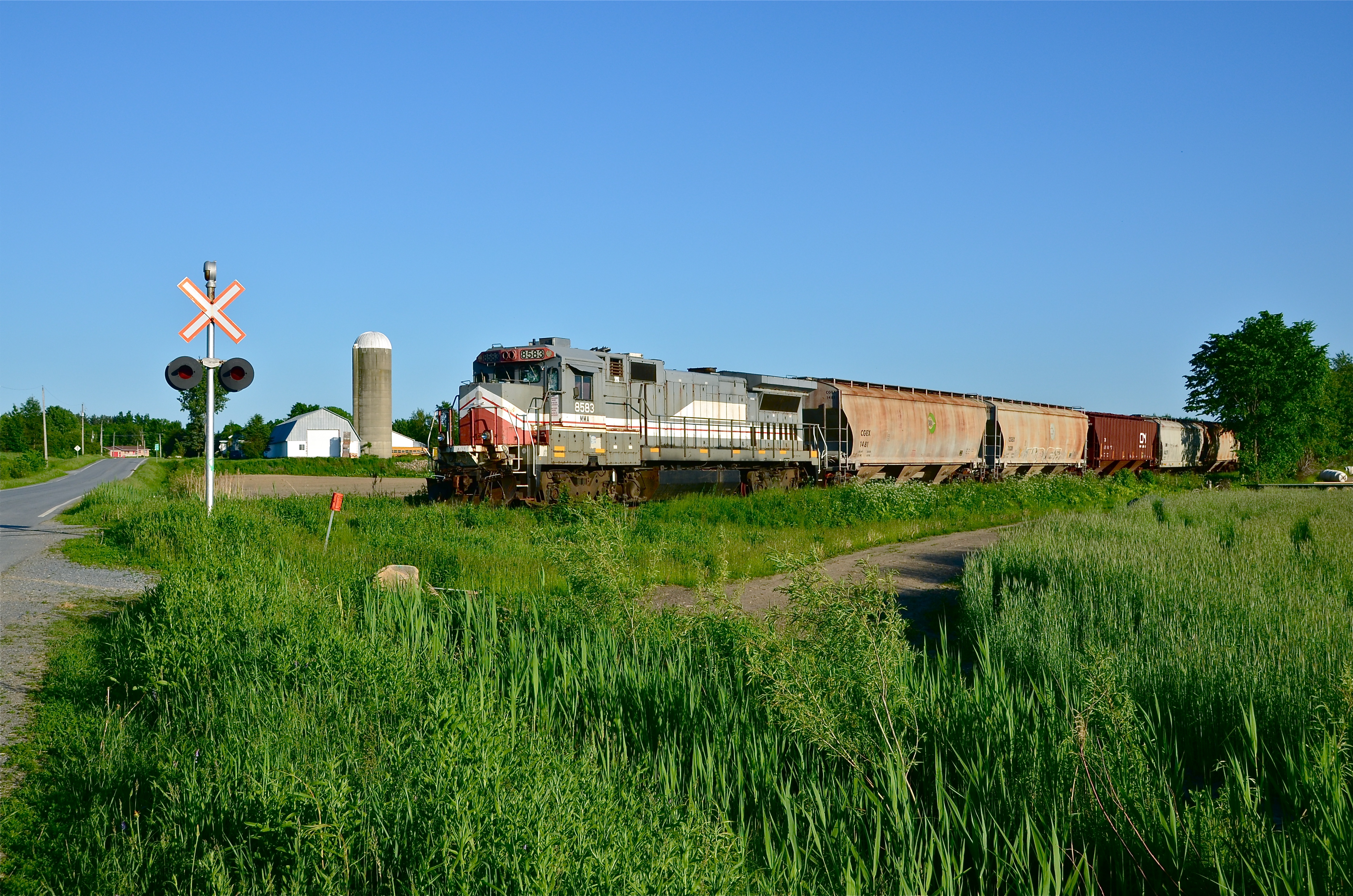
Re: Tracks out of service
That appears to be the MMA's former Stanbridge Sub, guess the CB&Q couldn't afford the repairs to the line, leading to it being torn up.
In fact, this line is the same one that the MMA had left an abandoned train on, complete with a B39-8 for power, due to poor condition of the track leading to it being embargoed by the Canadian government, and a derailment further north cutting off access to the train. The train was later rescued, but the locomotive was sadly scrapped.
Based on another picture, it appears that it was stranded next to this crossing.
They/Them for me, please.
Click here if you want to submit crossing photos to the site!
Avatar by runesprite on Twitter.
Click here if you want to submit crossing photos to the site!
Avatar by runesprite on Twitter.