Page 2 of 4
Re: Railroad Crossing Historical Analysis Archive
Posted: Thu Feb 18, 2016 5:46 pm
by NSrailfan4life
freebrickproductions wrote:Stickied the topic since it's gotten going. I'll probably post some crossings from my area soon.
Thanks man! I really appriciate it!
Re: Railroad Crossing Historical Analysis Archive
Posted: Fri Feb 19, 2016 11:05 pm
by NSrailfan4life

- holley.jpg (168.82 KiB) Viewed 38264 times
Holley, NY 3678 Co Rd 12
DOT Number: Unknown : 520914J
Google Maps Link:
https://www.google.com/maps/@43.2377878 ... 312!8i6656
----------------------------------------------------------------------------------------------------------------------------------------------------------------------------------
Signal History: The signal at the left no longer exists as it was knocked over a truck. There is a new signal installed there now. This is also the Near end of the Genesee Branch Line Eastside. (Info credit to Diesel Elevators)
Re: Railroad Crossing Historical Analysis Archive
Posted: Sat Feb 20, 2016 10:12 am
by ZachL
NSrailfan4life wrote:holley.jpg
Holley, NY 3678 Co Rd 12
DOT Number: Unknown : This needs to be Updated
Google Maps Link:
https://www.google.com/maps/@43.2377878 ... 312!8i6656
----------------------------------------------------------------------------------------------------------------------------------------------------------------------------------
Signal History: The signal at the left no longer exists as it was knocked over a truck. There is a new signal installed there now. This is also the Near end of the Genesee Branch Line Eastside. (Info credit to Diesel Elevators)
DOT number on this crossing is 520914J
Re: Railroad Crossing Historical Analysis Archive
Posted: Sat Feb 20, 2016 11:16 pm
by NSrailfan4life
NSrailfan4life wrote:holley.jpg
Holley, NY 3678 Co Rd 12
DOT Number: 520914J (Info Found by Zach L.)
Google Maps Link:
https://www.google.com/maps/@43.2377878 ... 312!8i6656
----------------------------------------------------------------------------------------------------------------------------------------------------------------------------------
Signal History: The signal at the left no longer exists as it was knocked over a truck. There is a new signal installed there now. This is also the Near end of the Genesee Branch Line Eastside. (Info credit to Diesel Elevators)
Re: Railroad Crossing Historical Analysis Archive
Posted: Mon May 02, 2016 1:10 pm
by NSrailfan4life
Alrighty Have a new one for the thread here. We have the Hollywood Blvd. Crossing along the FEC in Hollywood, FL. This crossing Recently Underwent a major transformation. Itnow has cantilevers and such as well as new PED masts and L.E.D.s on each one. One of the Cantilevers has Traffic Signals on it.
In the Past it was the only or few major crossings in South Florida without Cantilevers. All Inserts were also incandescent. I have Pics during the upgrade progress as I was recently in Florida. And then a fellow friendof Mine by the Name of Brickbuilder711 Has Pics of the Finished Project and crossing upgrade or whatever you want to call it.
---------------------------------------------------------------------------------------------------------------------------------------------------------------------------------------------------------
Crossing Operator: FEC 1939-Present Brightline: As Soon as 2017 Tri-Rail Costal: Possible as of 2017
CROSSING ID: Can't find. Maybe because of brightline.
Streetview before new setup /Circa 2000's/90's :
https://www.google.com/maps/place/Holly ... 68!6m1!1e1
Re: Railroad Crossing Historical Analysis Archive
Posted: Mon May 02, 2016 1:15 pm
by NSrailfan4life
Setup as of April 2016.
Re: Railroad Crossing Historical Analysis Archive
Posted: Mon May 02, 2016 3:00 pm
by freebrickproductions
Re: Railroad Crossing Historical Analysis Archive
Posted: Sun Sep 25, 2016 10:37 pm
by TrickyMario7654
Bit of a quick one on one of my local crossings...
Here's a closeup of the McGregor Road, Pakenham crossing active.
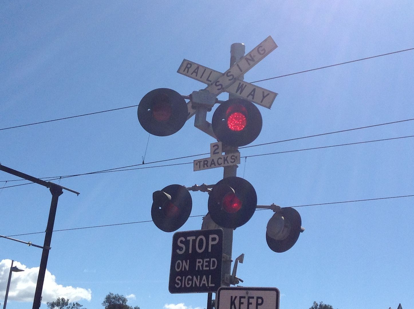
Streetview of the crossing in September 2015.
https://www.google.com.au/maps/@-38.078 ... 312!8i6656
It contains Westinghouse gate mechs, Westinghouse lights, and a General Signals Type 2 E-Bell.
Now here it is again in February of 2008.
https://www.google.com.au/maps/@-38.078 ... 328!8i1664
A few things have changed between 2008 & 2015. Here are some of the noticeable ones...
1. In 2008, the bells were Westinghouse Hybrid's. They were replaced with the current GS E-Bells in March 2014.
2008:
https://www.google.com.au/maps/@-38.078 ... 328!8i1664
2015:
https://www.google.com.au/maps/@-38.077 ... 312!8i6656
2. The pedestrian barriers on the left of the crossing were yellow in 2008. In 2015, they were red & white.
2008:
https://www.google.com.au/maps/@-38.077 ... 328!8i1664
2015:
https://www.google.com.au/maps/@-38.077 ... 312!8i6656
3. The pedestrian crossing on the right didn't even exist in 2008! The pedestrian crossing to the right opened in 2012.
2008:
https://www.google.com.au/maps/@-38.077 ... 328!8i1664
2015:
https://www.google.com.au/maps/@-38.077 ... 312!8i6656
Out of interest, the old telecommunication line towers near the railway are mostly still intact in some areas of Pakenham.
Re: Railroad Crossing Historical Analysis Archive
Posted: Mon Sep 26, 2016 12:44 pm
by NSrailfan4life
Thread not dead yet. Got 25 crossings to share Data on Very soon! :)
Re: Railroad Crossing Historical Analysis Archive
Posted: Mon Sep 26, 2016 12:45 pm
by NSrailfan4life