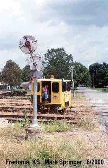
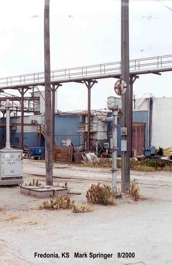
Found some "ghosts of signals past" in the Fredonia, KS area.
Remains of three signals here, one crossbuck and inverted "3 Tracks" sign remain, along with the relay case. Per a post I found on the Abandoned Rails Facebook group, this was an ex-Santa Fe line.
https://maps.app.goo.gl/irLVmvpFzaGHTWRv6
Moving south, here's a crossbuck that was just thrown in the bushes. There were actually two rights-of-way running parallel here, this is on the one to the east.
https://maps.app.goo.gl/adNQWEtTcatxa9k48
Looking at the Street View image history, it looks like the one to the west was actually out of service, then rebuilt starting around 2014. It cuts over to the east and uses a portion of the other RoW to serve a grain elevator on the far north edge of town. Looks like the original crossing between the two lines would have been just south of US 400.
Continuing south, this crossing has a relay case with a wire still going to it and the concrete remains of a battery box, but no traces of signals, just crossbucks on wooden posts. Looking at the history, that was the case back in 2014, as well.
https://maps.app.goo.gl/en6quxQdxnrfrNbm6
Traces of rail are still visible on the other RoW to the east:
https://maps.app.goo.gl/B7qpHmvZ8xsreZbW9
The only crossing along this stretch that appears to have active signals:
https://maps.app.goo.gl/weyJy8xiCdoC6RLb6
Continuing south, a relay case on a post (with a crossbuck on the front) with a wire going to it, and another battery box, but no actual warning devices. Looking at the post, maybe this was once a bell-only crossing but the bell was removed/stolen?
https://maps.app.goo.gl/LPf3H1b4ka9oPR5C8
More traces of rail on the parallel RoW to the east. Also check out the mural on the building to the right!
https://maps.app.goo.gl/YEAVvSz5gSc5tK3dA
Judging from the preserved depot and caboose, this was a Missouri Pacific line:
https://maps.app.goo.gl/dF4n6MmE8THNfS279
The next crossing south on the ex-Santa Fe has another orphaned relay case and battery box:
https://maps.app.goo.gl/6hAmL8Wv3Xn3FFnM9
Similar situation at the next one south, but the relay case is gone:
https://maps.app.goo.gl/tYLgw8gsPiZLo8Dw6
Looks like an orphaned advance warning sign for the long gone ex-MoPac crossing to the east, but it has a blue tag on it with the DOT number for the ex-ATSF crossing!
https://maps.app.goo.gl/d7B6YgRymQDZLWEe7
Back in 2014, there was no trace of active rail here at all!
https://maps.app.goo.gl/XLk95ZcpFAZrEUDD7
On the southwest side of town there was a crossing between the ex-Santa Fe line and a St.Louis-San Francisco (Frisco) line that came in from the southeast and then went west through New Albany, Fall River, Severy, etc. (Google's map view erroneously shows parts of this line as still existing despite its having been gone for at least 20 years). I found this. Possibly the remains of a wigwag?
https://maps.app.goo.gl/sysUyBvSihBc62PC9
Thought it might have been a US&S wigwag
like the one that was in Joplin, MO (also an ex-Frisco line), but the box on the mast looks different.