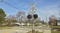
Google Street View

Talk about other non-signal stuff here. Make sure to obey the rules though.

Moderators: freebrickproductions, mlgillson, PlyingKibbles89, Raco_GS, Hopen111, TommyBNSF

User avatar
ToledoRailfan
No Longer Associated With The Forum
Posts: 3315
kuchnie-na-wymiar.wroclaw.pl
Joined: Sun Jul 21, 2013 2:38 pm

Re: Google Street View

Post by ToledoRailfan »

freebrickproductions wrote:This is a rather odd signal:
https://www.google.com/maps/@34.0663789 ... 56!6m1!1e1
And it is rather confusing too! :Confused:
User avatar
busman_49
Posts: 192
Joined: Fri Oct 31, 2014 1:32 pm

Re: Google Street View

Post by busman_49 »

freebrickproductions wrote:Abandoned and unfinished highways are another interest of mine. :Grin:
Mine too! I love this stuff! :TUP2:
User avatar
freebrickproductions
Posts: 9377
Joined: Thu Jun 07, 2012 11:12 am
Location: Huntsville, AL
Contact:

Re: Google Street View

Post by freebrickproductions »

busman_49 wrote:
freebrickproductions wrote:Abandoned and unfinished highways are another interest of mine. :Grin:

Mine too! I love this stuff! :TUP2:
Nice! Are there any in your area? I know here in Huntsville, on the north-side of town there are a pair of main-line stubs for AL 255 at the current end of the limited-access section:
https://www.google.com/maps/@34.7949583 ... authuser=0
They will be getting use when the City of Huntsville and ALDOT can both get around to getting the limited access section of AL 255 extended. I believe the plan is to widen the road that AL 255 connects to for the traffic on it to get to the Parkway and then extend AL 255 all the way to the Parkway.

Speaking of the Parkway, there used to be some unused sections of pavement, which have either been removed or are being prepped for use in the widening of the Parkway. This first one was originally going to be where traffic on Blanda Drive could access the Parkway northbound from, but it was removed last year by the city. If you look to the left, you can see where some traffic lights were (they were installed but never activated before they were removed), as the city decided that traffic on Blanda Drive would just have to turn right onto Whitesburg Drive. There were also some Do Not Enter signs on the left as well:
https://www.google.com/maps/@34.6512878 ... authuser=0
Then right here is an un-used ramp from the service road to the main-line for the Parkway. This ramp will go into use once the Parkway's widening is completed:
https://www.google.com/maps/@34.6517004 ... authuser=0
https://www.google.com/maps/@34.6527215 ... authuser=0
And right nearby is the stub for the service road. Same situation as above for the on-ramp, but it'll go into use earlier (if it hasn't already):
https://www.google.com/maps/@34.6531152 ... authuser=0
https://www.google.com/maps/@34.6551333 ... authuser=0

Not quite a highway, but off of Derrick Street and Holmes Avenue, there used to be a small section of a neighborhood that got torn down when I-565 was built. For example, this partially abandoned street originally went farther than it does now (even including the abandoned dead-end):
https://www.google.com/maps/@34.7291746 ... authuser=0
IIRC, it connected up with Derrick Street right over here:
https://www.google.com/maps/@34.7277211 ... authuser=0
There also used to be an extremely faded stop sign right here as well. The stop sign was completely white when I saw it.
https://www.google.com/maps/@34.7277125 ... authuser=0
This abandoned house is all that's left of the former neighborhood, IIRC:
https://www.google.com/maps/@34.7279506 ... authuser=0

There's also an abandoned section of Pelham Avenue behind the Huntsville & Madison County Public Library in downtown Huntsville. All that it can be used for is to access the back parking lot of an abandoned high school right next to said library:
https://www.google.com/maps/@34.7229174 ... authuser=0
The high school used to be where the black kids when to high school in the city before integration occurred. There's a group of people who are currently working to save most of it (the gym got torn down, probably due to structural issues) and are planning on turning it into a museum, IIRC.

Also, down in Birmingham, there's an abandoned off-ramp along US 31/US 280 in the downtown:
https://www.google.com/maps/@33.5178765 ... authuser=0
https://www.google.com/maps/@33.5181561 ... authuser=0
They/Them for me, please.

Click here if you want to submit crossing photos to the site!

Avatar by runesprite on Twitter.
User avatar
ZachL
Posts: 3029
Joined: Mon Dec 17, 2012 4:04 pm
Location: Hillsborough County/Tampa, FL

Re: Google Street View

Post by ZachL »

Reminds me on how Tarpon Springs, FL prides itself on its prominently Greek heritage. :Wink:
Crossing pictures from Plant City, FL are finally here! viewtopic.php?f=13&t=2538
User avatar
ToledoRailfan
No Longer Associated With The Forum
Posts: 3315
Joined: Sun Jul 21, 2013 2:38 pm

Re: Google Street View

Post by ToledoRailfan »

ZachL wrote:Reminds me on how Tarpon Springs, FL prides itself on its prominently Greek heritage. :Wink:
There is a historic Polish neighborhood here in Toledo which has a lot of Polish flags. There is also this village up in Michigan called Posen (named after the German name for Poznań) which has a lot of Polish flags as well. Around 75% of the town is Polish which is a higher percentage than any other village/town/city ect. in the United States and around 20% of the population there speak Polish at home! Although what is cool about the Acadian communities that I posted is that they span international borders with some of them being the only French speaking majority communities in the United States! I'm not sure if any of the ones in the United States that I posted here in particular had a French speaking majority though.

Edit: And typically stuff like that is just in one town in the surrounding area and not a whole bunch of towns in a region of the country, I'd really like to go up there sometime, there are a lot of cool crossings in Maine which I'd like to get to while I'm up there.
User avatar
freebrickproductions
Posts: 9377
Joined: Thu Jun 07, 2012 11:12 am
Location: Huntsville, AL
Contact:

Re: Google Street View

Post by freebrickproductions »

I'm not really sure of any cultural heritage that Huntsville prides itself on, but I do know we're very proud with rockets and the space industry. :Laugh:
https://www.google.com/maps/@34.7116228 ... authuser=0
https://www.google.com/maps/@34.6902298 ... authuser=0
https://www.google.com/maps/@34.7200724 ... authuser=0
https://www.google.com/maps/@34.7292372 ... authuser=0
My high school Spanish teacher (who's from Mississippi)once said that when she first came here, she was surprised by how much rockets and space exploration were just part of the general decoration/aesthetic here.

And of course, there's always the Eggbeater Jesus on Governors Drive: :LOL3:
https://www.google.com/maps/@34.7200482 ... authuser=0

Also, as a bit of a fun fact about the local history:
Originally, back in the 1960s, the US Air Force wanted to build a new base in a city in this area. After a while, the last two cities it came down to were Huntsville, AL and Tullahoma, TN for where they'd build this base, and they ultimately decided to go with Tullahoma, TN for the new base. However, as a bit of a consolation prize, Huntsville got NASA's Marshall Space Flight Center as a consolation prize. I guess no-one really expected that we'd end up being the much larger city because of that! :Tongue2:
They/Them for me, please.

Click here if you want to submit crossing photos to the site!

Avatar by runesprite on Twitter.
User avatar
ToledoRailfan
No Longer Associated With The Forum
Posts: 3315
Joined: Sun Jul 21, 2013 2:38 pm

Re: Google Street View

Post by ToledoRailfan »

freebrickproductions wrote:I'm not really sure of any cultural heritage that Huntsville prides itself on.
That is because you guys are just "American" and nothing else! :LOL3:

In the South most people tend to just consider themselves American probably because of most people down there are descended from English settlers who came here during the English (and maybe British) colonial days along with people being descended from west African slaves who came there around the same time.
User avatar
ToledoRailfan
No Longer Associated With The Forum
Posts: 3315
Joined: Sun Jul 21, 2013 2:38 pm

Re: Google Street View

Post by ToledoRailfan »

Here is Frankenmuth, Michigan. Even though it is definitely not the only city in Michigan and the Midwest as a whole with a German majority or plurality, what makes it unique is that it has a higher percentage of Germans compared to other villages and cities in the area, most of the settlers that the people here are descended from come from Bavaria instead of other parts of Germany, and this city was settled very early (in around 1845) compared to others. I also think that the people of this city were kind of kept to themselves throughout it's history. Because of it's uniqueness many of the older architecture in the city along with buildings and houses are similar to those found in Bavaria, and it is not like that is just for novelty or touristy reasons, that is just what they were familiar with. New buildings might also be similar to those in Bavaria but that could be for novelty touristy reasons or just to be traditional. And of coarse this city has a lot of German flags! :TUP2: 8.74% of the population speaks German, it probably wasn't that long ago that German was the main language there.

https://www.google.com/maps/@43.3268959 ... 6656?hl=en

https://www.google.com/maps/@43.3264213 ... 6656?hl=en

https://www.google.com/maps/@43.3256817 ... 6656?hl=en

https://www.google.com/maps/@43.3238365 ... 6656?hl=en

https://www.google.com/maps/@43.3226598 ... 6656?hl=en

https://www.google.com/maps/@43.3328226 ... 6656?hl=en

https://www.google.com/maps/@43.3282588 ... 6656?hl=en

This really isn't streetview but I thought the inside of the Chamber of Commerce would be worth sharing.
https://www.google.com/maps/@43.3277339 ... 6656?hl=en
https://www.google.com/maps/@43.3277216 ... 6656?hl=en

Again not really really street but here are some views of the Frankenmuth Historical Museum, this place was built in 1905!
https://www.google.com/maps/@43.3283334 ... 6656?hl=en
https://www.google.com/maps/@43.3282915 ... 6656?hl=en
https://www.google.com/maps/@43.3282443 ... 6656?hl=en
https://www.google.com/maps/@43.3281964 ... 6656?hl=en
https://www.google.com/maps/@43.328167, ... 6656?hl=en
https://www.google.com/maps/@43.3281741 ... 6656?hl=en
https://www.google.com/maps/@43.3281943 ... 6656?hl=en
User avatar
ToledoRailfan
No Longer Associated With The Forum
Posts: 3315
Joined: Sun Jul 21, 2013 2:38 pm

Re: Google Street View

Post by ToledoRailfan »

Post Reply