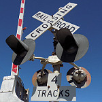
Crossings along the closed South Gippsland rail line (Last passenger train ran in 1993, last freight train ran in 1998. There's been a push recently to have the line re-opened. Some of these have already been shared on this site, some haven't):
The first one on the out of service portion of the line: https://www.google.com/maps/@-38.100720 ... 6656?hl=en
Further down the line: https://www.google.com/maps/@-38.106060 ... 6656?hl=en
Check out the bell position on this one: https://www.google.com/maps/@-38.116331 ... 6656?hl=en
Crossing only partly intact: https://www.google.com/maps/@-38.127348 ... 6656?hl=en
Partly intact crossbuck crossing: https://www.google.com/maps/@-38.169399 ... 1664?hl=en
And another one: https://www.google.com/maps/@-38.181883 ... 1664?hl=en
Not much left of this crossing: https://www.google.com/maps/@-38.189954 ... 1664?hl=en
This one is special to me as this particular crossing led me to discover about how the whole line had been abandoned and started up my goal of getting the line running again: https://www.google.com/maps/@-38.199690 ... 6656?hl=en
The signals were still left alone for a while even though the trail had been put in place: https://www.google.com/maps/@-38.199842 ... 6656?hl=en
The platform is still intact at Koo Wee Rup, albeit without the station building: https://www.google.com/maps/@-38.198182 ... 6656?hl=en
Picture of the station when the line was still in use: http://www.stationspast.net/wp-content/ ... p/kw01.jpg
Not much left of this one: https://www.google.com/maps/@-38.220419 ... 1664?hl=en
Same with this one: https://www.google.com/maps/@-38.244153 ... 1664?hl=en
Look at the weird lights set up on this one (You can also see an old-style track signal too): https://www.google.com/maps/@-38.264140 ... 6656?hl=en
Platform remains at Lang Lang station: https://www.google.com/maps/@-38.264106 ... 6656?hl=en
When trains still ran: http://www.stationspast.net/wp-content/ ... g/lg01.jpg
These signals have taken quite a beating: https://www.google.com/maps/@-38.274304 ... 1664?hl=en
Sadly, a lot the signals on this line have since been removed (however, most of the track is still intact, say for a section at Koo Wee Rup which has been converted to a trail, though the right-of-way is still intact and owned by VicTrack for future passenger and/or freight use along this line, even though it's been closed for a while now...) The section between Nyora and Leongatha has been operated as a tourist railway for many years, but the group who ran it collapsed earlier this year.
Tracks out of service
Moderators: freebrickproductions, mlgillson, PlyingKibbles89, Raco_GS, Hopen111, TommyBNSF
-
TrickyMario7654

- Posts: 1360
- kuchnie-na-wymiar.wroclaw.pl
- Joined: Fri Aug 26, 2016 6:45 pm
- Location: Melbourne, Australia
Re: Tracks out of service
Metro, why do you keep removing Mechanical bells?!
Click here if you want to see which crossings haven't been ruined by Metro Trains bell nazis.
Click here if you want to see which crossings haven't been ruined by Metro Trains bell nazis.
-
freebrickproductions

- Posts: 9305
- Joined: Thu Jun 07, 2012 11:12 am
- Location: Huntsville, AL
- Contact:
Re: Tracks out of service
GRS XB Lights! Amazing find there! Shame the signals aren't in use.TrickyMario7654 wrote:This one is special to me as this particular crossing led me to discover about how the whole line had been abandoned and started up my goal of getting the line running again: https://www.google.com/maps/@-38.199690 ... 6656?hl=en
The signals were still left alone for a while even though the trail had been put in place: https://www.google.com/maps/@-38.199842 ... 6656?hl=en
They/Them for me, please.
Click here if you want to submit crossing photos to the site!
Avatar by runesprite on Twitter.
Click here if you want to submit crossing photos to the site!
Avatar by runesprite on Twitter.
-
TrickyMario7654
- Posts: 1360
- Joined: Fri Aug 26, 2016 6:45 pm
- Location: Melbourne, Australia
Re: Tracks out of service
Woah! I wasn't even aware of that. The signals are no longer there sadly.freebrickproductions wrote:GRS XB Lights! Amazing find there! Shame the signals aren't in use.TrickyMario7654 wrote:This one is special to me as this particular crossing led me to discover about how the whole line had been abandoned and started up my goal of getting the line running again: https://www.google.com/maps/@-38.199690 ... 6656?hl=en
The signals were still left alone for a while even though the trail had been put in place: https://www.google.com/maps/@-38.199842 ... 6656?hl=en
On the other hand, here's this crossing were the road is closed shortly after the crossing (and has been since 2005). For some reason, the signals are still there more than a decade after the crossing closed! It's even got E-Bells and operates every time a train comes through. (BTW, this is located on the active portion of the South Gippsland line were suburban rail services run up to Cranbourne): https://www.google.com.au/maps/@-38.073 ... 312!8i6656
Speaking of crossings that are on a road to nowhere, there was this one in my local township on Ryan Road in which the crossing was closed to allow the construction of the bypass in order to route traffic out of the town. But for some reason, no one removed the signals at the crossing! 7 News made a report on how the crossing still operates despite the road being closed at that point (one of my father's friends appear in it too!): https://www.youtube.com/watch?v=nAFN83MZ6G8
Since then, the signals have been removed: https://www.google.com.au/maps/@-38.084 ... 312!8i6656
But still, it's pretty funny on how mistakes like these could be made.

Last edited by TrickyMario7654 on Tue Sep 06, 2016 11:43 pm, edited 2 times in total.
Metro, why do you keep removing Mechanical bells?!
Click here if you want to see which crossings haven't been ruined by Metro Trains bell nazis.
Click here if you want to see which crossings haven't been ruined by Metro Trains bell nazis.
-
freebrickproductions
- Posts: 9305
- Joined: Thu Jun 07, 2012 11:12 am
- Location: Huntsville, AL
- Contact:
Re: Tracks out of service
Heh, reminds me of Monroe Street in Courtland, AL before the signals were removed:TrickyMario7654 wrote: Speaking of crossings that are on a road to nowhere, there was this one in my local township on Ryan Road in which the crossing was closed to allow the construction of the bypass in order to route traffic out of the town. But for some reason, no one removed the signals at the crossing! 7 News made a report on how the crossing still operates despite the road being closed at that point (one of my father's friends appear in it too!): https://www.youtube.com/watch?v=nAFN83MZ6G8
Since then, the signals have been removed: https://www.google.com.au/maps/@-38.084 ... 312!8i6656
But still, it's pretty funny on how mistakes like these could be made.
(Original Post can be found here.)freebrickproductions wrote:However, since the relay case is still hooked-up, the signals still activate for trains:
Closed Monroe Street Crossing in Courtland, AL by freebrickproductions, on Flickr
NS A12 by freebrickproductions, on Flickr
I may end up splitting this into another thread if this discussion continues, to keep this thread on track.
They/Them for me, please.
Click here if you want to submit crossing photos to the site!
Avatar by runesprite on Twitter.
Click here if you want to submit crossing photos to the site!
Avatar by runesprite on Twitter.
-
McK&H.Aust

- Posts: 926
- Joined: Tue Feb 16, 2016 8:16 am
- Location: Sydney, Australia
Re: Tracks out of service
That reminds me of a crossing I saw in Adelaide when I visited a couple of years ago. It is near Kilkenny station and must have been a private crossing but is now fenced off and the road been torn up, however the signals still remain. The most recent image from 2013 also shows the crossing active https://www.google.com.au/maps/@-34.887 ... 312!8i6656TrickyMario7654 wrote:On the other hand, here's this crossing were the road is closed shortly after the crossing (and has been since 2005). For some reason, the signals are still there more than a decade after the crossing closed! It's even got E-Bells and operates every time a train comes through. (BTW, this is located on the active portion of the South Gippsland line were suburban rail services run up to Cranbourne): https://www.google.com.au/maps/@-38.073 ... 312!8i6656
Another view from 2009 https://www.google.com.au/maps/@-34.887 ... 312!8i6656
-
McK&H.Aust
- Posts: 926
- Joined: Tue Feb 16, 2016 8:16 am
- Location: Sydney, Australia
Re: Tracks out of service
That looks like it could be a super rare Westinghouse teardrop bell. If you zoom right in you can just make out the round Westinghouse logo https://www.google.com/maps/@-38.116331 ... 6656?hl=enTrickyMario7654 wrote:Check out the bell position on this one: https://www.google.com/maps/@-38.116331 ... 6656?hl=en
Those are (or were) some really nice old crossings along that line, it's a shame they are gone. I guess if they do re-open the line they would probably replace them with new signals anyway. I just hope some of that old equipment (specially those XB lights and teardrop bells) went to a good home and not in the scrap bin.
-
TrickyMario7654
- Posts: 1360
- Joined: Fri Aug 26, 2016 6:45 pm
- Location: Melbourne, Australia
Re: Tracks out of service
If I remember correctly, someone told me that they knew someone that had the crossing signals from the Koo Wee Rup crossing in their backyard.McK&H.Aust wrote:That looks like it could be a super rare Westinghouse teardrop bell. If you zoom right in you can just make out the round Westinghouse logo https://www.google.com/maps/@-38.116331 ... 6656?hl=enTrickyMario7654 wrote:Check out the bell position on this one: https://www.google.com/maps/@-38.116331 ... 6656?hl=en
Those are (or were) some really nice old crossings along that line, it's a shame they are gone. I guess if they do re-open the line they would probably replace them with new signals anyway. I just hope some of that old equipment (specially those XB lights and teardrop bells) went to a good home and not in the scrap bin.
BTW, on my version of the re-opened line, the crossings have a mix of old and new equipment.
Metro, why do you keep removing Mechanical bells?!
Click here if you want to see which crossings haven't been ruined by Metro Trains bell nazis.
Click here if you want to see which crossings haven't been ruined by Metro Trains bell nazis.
-
brett nc railfanner
- Posts: 591
- Joined: Sun Jun 14, 2015 8:50 am
- Location: San Diego, CA
Re: Tracks out of service
https://www.google.com/maps/@44.3042375 ... 328!8i1664 I don't know if this was posted before.
-
freebrickproductions
- Posts: 9305
- Joined: Thu Jun 07, 2012 11:12 am
- Location: Huntsville, AL
- Contact:
Re: Tracks out of service
I think I posted it once before, but I can't remember if I did. I know it's featured on the AbandonedRails website (which is finally active again!).brett nc railfanner wrote:https://www.google.com/maps/@44.3042375 ... 328!8i1664 I don't know if this was posted before.
They/Them for me, please.
Click here if you want to submit crossing photos to the site!
Avatar by runesprite on Twitter.
Click here if you want to submit crossing photos to the site!
Avatar by runesprite on Twitter.

Re: Tracks out of service
There's a whole bunch of abandoned crossings on the former Tasrail line to Hobart. Only the bells (Mostly WCH E-Bells) remain in place today. Here are some examples:
https://www.google.com.au/maps/@-42.853 ... 56!6m1!1e1
https://www.google.com.au/maps/@-42.839 ... 56!6m1!1e1
https://www.google.com.au/maps/@-42.835 ... 56!6m1!1e1
https://www.google.com.au/maps/place/Ho ... 49!6m1!1e1
This crossing doesn't have any active equipment left:
https://www.google.com.au/maps/@-42.800 ... 56!6m1!1e1
The one crossing on the line with a WRRS mechanical bell leftover:
https://www.google.com.au/maps/@-42.792 ... 56!6m1!1e1
This crossing is still yet to have its signals removed:
https://www.google.com.au/maps/@-42.748 ... 56!6m1!1e1