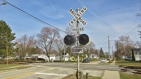
Here's some old National Route 1 markers/signs I've noticed along the old route of the Princes Highway and nearby roads.
This one near the intersection of Toomuc Valley Road & Princes Highway in Pakenham still remains (as I drove by it two days ago)
https://www.google.com.au/maps/@-38.063 ... 312!8i6656
Just further down the road, is this newer (but outdated) direction signs for the M1. This section of the highway was renumbered C101 following the opening of the Pakenham bypass (which received the M1 number). It notes Melbourne to the right, and Warragul to the left...
https://www.google.com.au/maps/@-38.063 ... 312!8i6656
But as with most direction signs along the old highway route, the Warragul-bound sign was changed to Pakenham, and the Melbourne-bound sign was changed to Berwick.
https://www.google.com.au/maps/@-38.064 ... 312!8i6656
Here's what the Berwick direction sign used to say...
https://www.google.com.au/maps/@-38.064 ... 328!8i1664
Here's two I've noticed in Officer last year while getting the crossings in the area...
The first one is on a directions sign located at Station Street, shortly before the Princess Highway intersection.
https://www.google.com.au/maps/@-38.060 ... 312!8i6656
Another one at Brunt Road, again, shortly before the Princes Highway intersection.
https://www.google.com.au/maps/@-38.056 ... 312!8i6656
An old State Route 180 shield on a direction sign at the South Gippsland Highway intersection of the Princes Highway in Dandenong South. The State Route shields replaced with A, B, & C routes in the late 1990's, so I don't know how this one still remains.
https://www.google.com.au/maps/@-38.000 ... 312!8i6656
There used to be a END 180 sign on the other side of the road, but it was removed sometime after 2010. (I do remember driving by it at some point before it was removed)
https://www.google.com.au/maps/@-38.001 ... 312!8i6656
I found this outdated Metropolitan Route 63 shield at Webb Street in Narre Warren.
https://www.google.com.au/maps/@-38.024 ... 312!8i6656
Not only has Route 63 been redirected onto a diversion of Narre Warren North Road, but it was replaced with C404 in the late 1990's!
Before the early 1990's, Webb Street used to connect to Narre Warren North Road, with traffic having to turn left onto Princes Highway from Webb Street, before turning right onto Cranbourne Road. The 1990 edition shows the old route, with the future route showed in dotted, transparent lines.
https://digitised-collections.unimelb.e ... quence=142
The 1991 edition shows the link under construction.
https://digitised-collections.unimelb.e ... quence=142
By the time the 1993 edition came out, the link had been finished and the route 63 shield was moved onto the new road link. Webb Street was also closed at where it used to connect to Narre Warren North Road.
https://digitised-collections.unimelb.e ... quence=150
By the late 1990's, the reroute had proven to be a good idea as the road had been duplicated up to where the highway was and merged down to one lane in each direction by the time you reached where the level crossing on Cranbourne Road.
https://digitised-collections.unimelb.e ... quence=156
In 2004, the road was further upgraded, with the level crossing replaced with an underpass.
https://www.google.com.au/maps/@-38.028 ... 312!8i6656
Here's some pictures I've found of the former level crossing on Railpage, taken back in 2002.
https://www.railpage.com.au/gallery?image=28240
https://www.railpage.com.au/gallery?image=28198
https://www.railpage.com.au/gallery?image=28197
https://www.railpage.com.au/gallery?image=28147