
1 Track signs? I have only seen ONE other example of this in my area.
Speaking of track signs I managed to notice a pair of inverted track signs. Here is one in comparison with the modern white on black. Here is the other. For those that have sharp eyes and are wondering what these are, those would be old catenary mast bases for this was the old passenger lead in to Seattle's Union Station. MILW Bi-Polars and Box-cabs once ran on these very rails at one point in time.
Google Maps Scavenger Hunt
Moderators: freebrickproductions, mlgillson, PlyingKibbles89, Raco_GS, Hopen111, TommyBNSF
-
Erik-Gorb-Hamilton

- Posts: 180
- kuchnie-na-wymiar.wroclaw.pl
- Joined: Wed Jun 07, 2017 12:25 am
Re: Google Maps Scavenger Hunt
Continuing my
Grandfathers
Legacy
CEO of the Stratford Gap Railway
Grandfathers
Legacy
CEO of the Stratford Gap Railway
-
ToledoRailfan
- No Longer Associated With The Forum
- Posts: 3315
- Joined: Sun Jul 21, 2013 2:38 pm
Re: Google Maps Scavenger Hunt
The signal kind of looks cool covered in moss. I wonder why this specific piece of track is surrounded by fencing?Erik-Gorb-Hamilton wrote:1 Track signs? I have only seen ONE other example of this in my area.


-
freebrickproductions

- Posts: 9377
- Joined: Thu Jun 07, 2012 11:12 am
- Location: Huntsville, AL
- Contact:
Re: Google Maps Scavenger Hunt
Maybe a shortline stores their engine(s) there?ToledoRailfan wrote:The signal kind of looks cool covered in moss. I wonder why this specific piece of track is surrounded by fencing?Erik-Gorb-Hamilton wrote:1 Track signs? I have only seen ONE other example of this in my area.
They/Them for me, please.
Click here if you want to submit crossing photos to the site!
Avatar by runesprite on Twitter.
Click here if you want to submit crossing photos to the site!
Avatar by runesprite on Twitter.
-
freebrickproductions
- Posts: 9377
- Joined: Thu Jun 07, 2012 11:12 am
- Location: Huntsville, AL
- Contact:
Re: Google Maps Scavenger Hunt
Active crossing in Birmingham, AL:
https://www.google.com/maps/@33.490677, ... 312!8i6656
https://www.google.com/maps/@33.490677, ... 312!8i6656
They/Them for me, please.
Click here if you want to submit crossing photos to the site!
Avatar by runesprite on Twitter.
Click here if you want to submit crossing photos to the site!
Avatar by runesprite on Twitter.

Re: Google Maps Scavenger Hunt
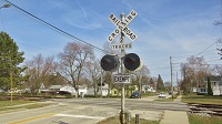
I've always wondered why CSX inserted WCH LED lights into Safetran heads. I don't think they don't do it anymore, although I still have seen the occasional new install/upgrade install with them as well.
Crossing pictures from Plant City, FL are finally here! viewtopic.php?f=13&t=2538
-
Erik-Gorb-Hamilton
- Posts: 180
- Joined: Wed Jun 07, 2017 12:25 am
Re: Google Maps Scavenger Hunt
Correct. The fenced off area is the engine house for the Eastside Freight Railway. They run over the former NP Mainline to Canada to an interchange at a place called Snohomish WA with the BNSF. The track going up the hill used to go all the way to Renton WA and was utilized by the Spirit of Washington Dinner Train. After 20-30 years of operation they had to close due to a widening project on I-405 which replaced a tunnel. The BNSF had no customers on that line so they decided not to renew the lease to the Dinner Train. The tracks go up he hill then turn into a trail for most of the way. At a place called Kirkland it reverts back into track that crosses a HUGE trestle called the Wilburton Trestle. Afterwards the track is removed and it crossed I-405. After that the track comes in again and runs all the way down to Renton still. The Renton section is still used by the BNSF to deliver some of those 737 Fuselages you see every now and then. At the diamond the line to the right (viewing the engine house) was the line to Snoqaulmie WA , Where the Northwest Railway Museum runs. That was also the way of the Dinner train since that was also the way to the Columbia Winery. The line to the left is the old NP line through Seattle. Tracks on that section end about 1000 ft from this location.freebrickproductions wrote:Maybe a shortline stores their engine(s) there?ToledoRailfan wrote:The signal kind of looks cool covered in moss. I wonder why this specific piece of track is surrounded by fencing?Erik-Gorb-Hamilton wrote:1 Track signs? I have only seen ONE other example of this in my area.
~This has been a Historical Knowledge Session from Erik

Continuing my
Grandfathers
Legacy
CEO of the Stratford Gap Railway
Grandfathers
Legacy
CEO of the Stratford Gap Railway
-
ToledoRailfan
- No Longer Associated With The Forum
- Posts: 3315
- Joined: Sun Jul 21, 2013 2:38 pm
Re: Google Maps Scavenger Hunt
So after this crossing was removed and the station platform was extended, the signals were still in place for a bit!
https://www.google.com/maps/@43.4560669 ... 2000?hl=en
https://www.google.com/maps/@43.4560669 ... 2000?hl=en
------------------------------------------------------------
Here are two classic cantilever signals.
https://www.google.com/maps/@43.4710935 ... 6656?hl=en
https://www.google.com/maps/@43.470723, ... 6656?hl=en
One of them was later replaced by this somewhat strange looking signal.
Both of the signals were later removed.
https://www.google.com/maps/@43.4710422 ... 6656?hl=en
https://www.google.com/maps/@43.4707288 ... 6656?hl=en
They were later reinstalled but on different sides of the crossing. Although they were later replaced.
https://www.google.com/maps/@43.4707114 ... 6656?hl=en
https://www.google.com/maps/@43.4708972 ... 6656?hl=en
------------------------------------------------------------
I wonder why these temporary crossbucks were so far from the crossing? Maybe to prevent them from getting in the way of construction.
https://www.google.com/maps/@43.4854418 ... 6656?hl=en
https://www.google.com/maps/@43.4855961 ... 6656?hl=en
Here it is more obvious as to why they did it.
https://www.google.com/maps/@43.486523, ... 6656?hl=en
https://www.google.com/maps/@43.4866296 ... 6656?hl=en
https://www.google.com/maps/@43.4560669 ... 2000?hl=en
https://www.google.com/maps/@43.4560669 ... 2000?hl=en
------------------------------------------------------------
Here are two classic cantilever signals.
https://www.google.com/maps/@43.4710935 ... 6656?hl=en
https://www.google.com/maps/@43.470723, ... 6656?hl=en
One of them was later replaced by this somewhat strange looking signal.
Both of the signals were later removed.
https://www.google.com/maps/@43.4710422 ... 6656?hl=en
https://www.google.com/maps/@43.4707288 ... 6656?hl=en
They were later reinstalled but on different sides of the crossing. Although they were later replaced.
https://www.google.com/maps/@43.4707114 ... 6656?hl=en
https://www.google.com/maps/@43.4708972 ... 6656?hl=en
------------------------------------------------------------
I wonder why these temporary crossbucks were so far from the crossing? Maybe to prevent them from getting in the way of construction.
https://www.google.com/maps/@43.4854418 ... 6656?hl=en
https://www.google.com/maps/@43.4855961 ... 6656?hl=en
Here it is more obvious as to why they did it.
https://www.google.com/maps/@43.486523, ... 6656?hl=en
https://www.google.com/maps/@43.4866296 ... 6656?hl=en
-
freebrickproductions
- Posts: 9377
- Joined: Thu Jun 07, 2012 11:12 am
- Location: Huntsville, AL
- Contact:
Re: Google Maps Scavenger Hunt
WCH LEDs were cheaper, probably. Or it was at the very least the cheapest LED that NEG and/or Progress Rail offered.ZachL wrote:I've always wondered why CSX inserted WCH LED lights into Safetran heads. I don't think they don't do it anymore, although I still have seen the occasional new install/upgrade install with them as well.
They/Them for me, please.
Click here if you want to submit crossing photos to the site!
Avatar by runesprite on Twitter.
Click here if you want to submit crossing photos to the site!
Avatar by runesprite on Twitter.
Re: Google Maps Scavenger Hunt
Wonder where the Safetran heads, backgrounds and visors came from then. Did CSX manually repaint/refurbish those?freebrickproductions wrote:WCH LEDs were cheaper, probably. Or it was at the very least the cheapest LED that NEG and/or Progress Rail offered.ZachL wrote:I've always wondered why CSX inserted WCH LED lights into Safetran heads. I don't think they don't do it anymore, although I still have seen the occasional new install/upgrade install with them as well.
Crossing pictures from Plant City, FL are finally here! viewtopic.php?f=13&t=2538
-
freebrickproductions
- Posts: 9377
- Joined: Thu Jun 07, 2012 11:12 am
- Location: Huntsville, AL
- Contact:
Re: Google Maps Scavenger Hunt
Probably also sourced from NEG and/or Progress Rail.ZachL wrote:Wonder where the Safetran heads, backgrounds and visors came from then. Did CSX manually repaint/refurbish those?freebrickproductions wrote:WCH LEDs were cheaper, probably. Or it was at the very least the cheapest LED that NEG and/or Progress Rail offered.ZachL wrote:I've always wondered why CSX inserted WCH LED lights into Safetran heads. I don't think they don't do it anymore, although I still have seen the occasional new install/upgrade install with them as well.
They/Them for me, please.
Click here if you want to submit crossing photos to the site!
Avatar by runesprite on Twitter.
Click here if you want to submit crossing photos to the site!
Avatar by runesprite on Twitter.