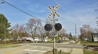
Nothing odd about it. That was the yield sign in use from 1961-1971, and is the design that predates the one we know and love today.ToledoRailfan wrote:Old yield sign in Portage, Indiana.
https://www.google.com/maps/@41.6231901 ... 6656?hl=en
Google Street View
Moderators: freebrickproductions, mlgillson, PlyingKibbles89, Raco_GS, Hopen111, TommyBNSF
-
ZachL

- Posts: 3029
- kuchnie-na-wymiar.wroclaw.pl
- Joined: Mon Dec 17, 2012 4:04 pm
- Location: Hillsborough County/Tampa, FL
Re: Google Street View
Crossing pictures from Plant City, FL are finally here! viewtopic.php?f=13&t=2538
-
ToledoRailfan
- No Longer Associated With The Forum
- Posts: 3315
- Joined: Sun Jul 21, 2013 2:38 pm
Re: Google Street View
ZachL wrote:Nothing odd about it. That was the yield sign in use from 1961-1971, and is the design that predates the one we know and love today.ToledoRailfan wrote:Old yield sign in Portage, Indiana.
https://www.google.com/maps/@41.6231901 ... 6656?hl=en
ToledoRailfan wrote:Old

-
ToledoRailfan
- No Longer Associated With The Forum
- Posts: 3315
- Joined: Sun Jul 21, 2013 2:38 pm
Re: Google Street View
High-rail truck being put on the tracks in Mississauga, Ontario.
https://www.google.com/maps/@43.5534806 ... 6656?hl=en
https://www.google.com/maps/@43.5535018 ... 6656?hl=en
https://www.google.com/maps/@43.5535229 ... 6656?hl=en
https://www.google.com/maps/@43.5534806 ... 6656?hl=en
https://www.google.com/maps/@43.5535018 ... 6656?hl=en
https://www.google.com/maps/@43.5535229 ... 6656?hl=en
-
ToledoRailfan
- No Longer Associated With The Forum
- Posts: 3315
- Joined: Sun Jul 21, 2013 2:38 pm

-
freebrickproductions

- Posts: 9379
- Joined: Thu Jun 07, 2012 11:12 am
- Location: Huntsville, AL
- Contact:
Re: Google Street View
I'm more interested in these signs right up the road, which appear to have once held some shields on them?
https://www.google.com/maps/@30.3208569 ... 6656?hl=en
They/Them for me, please.
Click here if you want to submit crossing photos to the site!
Avatar by runesprite on Twitter.
Click here if you want to submit crossing photos to the site!
Avatar by runesprite on Twitter.
-
ToledoRailfan
- No Longer Associated With The Forum
- Posts: 3315
- Joined: Sun Jul 21, 2013 2:38 pm
Re: Google Street View
Huh, that is pretty odd as well.freebrickproductions wrote:I'm more interested in these signs right up the road, which appear to have once held some shields on them?
https://www.google.com/maps/@30.3208569 ... 6656?hl=en

Re: Google Street View
Do you mean all the screws that appear to be sticking out? I think that is an extra secure way to mount the signs to their frames... probably to better protect them from the wind.freebrickproductions wrote:I'm more interested in these signs right up the road, which appear to have once held some shields on them?
https://www.google.com/maps/@30.3208569 ... 6656?hl=en
https://www.google.com/maps/@30.3212089 ... 6656?hl=en
This smaller exit sign on the other side of the bridge has them also:
https://www.google.com/maps/@30.32436,- ... 6656?hl=en
https://www.google.com/maps/@30.3244066 ... 6656?hl=en
Re: Google Street View
Shield as in highway shieldcabman701 wrote:Do you mean all the screws that appear to be sticking out? I think that is an extra secure way to mount the signs to their frames... probably to better protect them from the wind.

Crossing pictures from Plant City, FL are finally here! viewtopic.php?f=13&t=2538
-
freebrickproductions
- Posts: 9379
- Joined: Thu Jun 07, 2012 11:12 am
- Location: Huntsville, AL
- Contact:
Re: Google Street View
We actually have a sign like this here in Huntsville on Jordan Lane at I-565 where this sign once held an AL 53 shield:ToledoRailfan wrote:Huh, that is pretty odd as well.freebrickproductions wrote:I'm more interested in these signs right up the road, which appear to have once held some shields on them?
https://www.google.com/maps/@30.3208569 ... 6656?hl=en
https://www.google.com/maps/@34.7191811 ... 312!8i6656
The reason behind that is because the contractor making the original signs for I-565 didn't know where AL 53 went at this intersection (it goes down Governors Drive to Memorial Parkway from here, along with AL 20 before it was truncated to I-65 in Decatur around the time I-565 was built), so they just put up the AL 53 shield on the thru traffic sign for Jordan Lane while the sign for Governors Drive (on the left) got an AL 20 shield. However, ALDOT corrected this mistake by moving the AL 53 shield over to the proper sign and putting it where the AL 20 shield was. The signs on the other side also have a space where an AL 20 shield went, along with the greenout used on the cardinal direction for I-565 being more visible:
https://www.google.com/maps/@34.7187366 ... 312!8i6656
And this sign, on the side of the intersection, if you look closely, you can see where they used greenout to correct the cardinal directions on it when the AL 20 shield was replaced with an AL 53 shield:
https://www.google.com/maps/@34.7178126 ... 312!8i6656
They/Them for me, please.
Click here if you want to submit crossing photos to the site!
Avatar by runesprite on Twitter.
Click here if you want to submit crossing photos to the site!
Avatar by runesprite on Twitter.
-
ToledoRailfan
- No Longer Associated With The Forum
- Posts: 3315
- Joined: Sun Jul 21, 2013 2:38 pm
Re: Google Street View
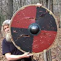
Sure it wasn't this shield?!ZachL wrote:Shield as in highway shieldcabman701 wrote:Do you mean all the screws that appear to be sticking out? I think that is an extra secure way to mount the signs to their frames... probably to better protect them from the wind.