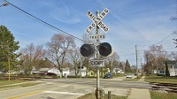
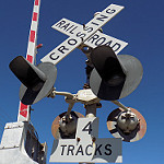
Tracks out of service
Moderators: freebrickproductions, mlgillson, PlyingKibbles89, Raco_GS, Hopen111, TommyBNSF
-
Erik-Gorb-Hamilton

- Posts: 180
- kuchnie-na-wymiar.wroclaw.pl
- Joined: Wed Jun 07, 2017 12:25 am
Re: Tracks out of service
Continuing my
Grandfathers
Legacy
CEO of the Stratford Gap Railway
Grandfathers
Legacy
CEO of the Stratford Gap Railway
-
freebrickproductions

- Posts: 9377
- Joined: Thu Jun 07, 2012 11:12 am
- Location: Huntsville, AL
- Contact:
Re: Tracks out of service
Other than those signals, I literally can't see any sign of the former line though there!Erik-Gorb-Hamilton wrote:One crossing on the old Maine Central Mountain Division...
They/Them for me, please.
Click here if you want to submit crossing photos to the site!
Avatar by runesprite on Twitter.
Click here if you want to submit crossing photos to the site!
Avatar by runesprite on Twitter.
-
ToledoRailfan
- No Longer Associated With The Forum
- Posts: 3315
- Joined: Sun Jul 21, 2013 2:38 pm
Re: Tracks out of service
There is a passive crossing nearby that is a lot like that. Very scenic area those crossings are as well.freebrickproductions wrote:Other than those signals, I literally can't see any sign of the former line though there!Erik-Gorb-Hamilton wrote:One crossing on the old Maine Central Mountain Division...
https://www.google.com/maps/@44.4281769 ... 312!8i6656
https://www.google.com/maps/@44.4283663 ... 312!8i6656
There is a bit of exposed rail there.
https://www.google.com/maps/@44.4283663 ... 312!8i6656
Interestingly enough the signage at the crossing looks pretty new!
If you go on Google Earth there is a short stretch of track that is still visible.
https://www.google.com/maps/@44.4277434 ... a=!3m1!1e3
Other than that you really can't tell that there is/was a line there. Unless of coarse you're looking for one, even then it'd still be pretty hard. I'm surprised that the line is shown on Maps.
https://www.google.com/maps/@44.4276199 ... a=!3m1!1e3
-------
More visible track.
https://www.google.com/maps/@44.4488717 ... a=!3m1!1e3
https://www.google.com/maps/@44.4546096 ... a=!3m1!1e3
-------
This is pretty crazy... Remove the signals and relay cabinet and you'd have no idea there was a crossing and line there! And the signals are in pretty good condition! This is why I enjoy abandoned crossings.
https://www.google.com/maps/@44.4554502 ... 312!8i6656
https://www.google.com/maps/@44.4555529 ... 312!8i6656
-------
This passive crossing still has the track there/exposed until the crossing itself.
https://www.google.com/maps/@44.4680522 ... 312!8i6656
https://www.google.com/maps/@44.4679685 ... 312!8i6656
https://www.google.com/maps/@44.4679685 ... 312!8i6656
https://www.google.com/maps/@44.4679624 ... a=!3m1!1e3
-------
You could get some good photos or video here.
https://www.google.com/maps/@44.4538112 ... 312!8i6656
Kinda having a bit of da sha vu here. I think I might've posted this part of the line here before.
-------
Pretty cool private crossing.
https://www.google.com/maps/@44.4498166 ... 312!8i6656
-
ToledoRailfan
- No Longer Associated With The Forum
- Posts: 3315
- Joined: Sun Jul 21, 2013 2:38 pm
Re: Tracks out of service
Abandoned spur in Calico Rock, Arkansas.
https://www.google.com/maps/@36.1163773 ... 6656?hl=en
https://www.google.com/maps/@36.1164706 ... 6656?hl=en
https://www.google.com/maps/@36.1164706 ... 6656?hl=en
https://www.google.com/maps/@36.117422, ... 1664?hl=en
https://www.google.com/maps/@36.1171737 ... !1e3?hl=en
https://www.google.com/maps/@36.1163773 ... 6656?hl=en
https://www.google.com/maps/@36.1164706 ... 6656?hl=en
https://www.google.com/maps/@36.1164706 ... 6656?hl=en
https://www.google.com/maps/@36.117422, ... 1664?hl=en
https://www.google.com/maps/@36.1171737 ... !1e3?hl=en
-
Erik-Gorb-Hamilton
- Posts: 180
- Joined: Wed Jun 07, 2017 12:25 am
Re: Tracks out of service
Been on a MEC stint the past couple of days. The Mountain Division looks pretty much intact (and runable!) up until Concord. I do believe with some maintenance you could run a train from Portland ME to Whitehall NH.
Neat fact: At Whitehall, there stands the last Ball signal anywhere in the US on a railroad. This signal is where the term Highball came from!
https://www.google.com/maps/@44.370506, ... 312!8i6656
Neat fact: At Whitehall, there stands the last Ball signal anywhere in the US on a railroad. This signal is where the term Highball came from!
https://www.google.com/maps/@44.370506, ... 312!8i6656
Continuing my
Grandfathers
Legacy
CEO of the Stratford Gap Railway
Grandfathers
Legacy
CEO of the Stratford Gap Railway

Re: Tracks out of service
Actually, from the videos I'm seeing on YouTube, the Conway Scenic Railroad does operate up to the signal, and has done so a few times in the last year... running a train named the Red Ball Special.Erik-Gorb-Hamilton wrote:Been on a MEC stint the past couple of days. The Mountain Division looks pretty much intact (and runable!) up until Concord. I do believe with some maintenance you could run a train from Portland ME to Whitehall NH.
Neat fact: At Whitehall, there stands the last Ball signal anywhere in the US on a railroad. This signal is where the term Highball came from!
https://www.google.com/maps/@44.370506, ... 312!8i6656
Well, 
-
NathanFromEngland

- Posts: 2377
- Joined: Sat Apr 29, 2017 3:52 pm
- Location: Merseyside
Re: Tracks out of service
Abandoned shortline in Northeastern California, near the Oregon border. Research suggests this was last used by Arcata and Mad River Railroad which went bust in 1985, but wasn't abandoned until 1993. But this line goes on for MILES, so i may not be correct.
The first crossing basically has nothing, just a grade.
https://www.google.co.uk/maps/@40.82090 ... 312!8i6656
The second crossing is a narrow road, but i'm guessing it may've just had a pair of crossbucks.
https://www.google.co.uk/maps/@40.84702 ... 312!8i6656
There's a stop sign here, so maybe they were STOP sign crossings?
https://www.google.co.uk/maps/@40.84967 ... 312!8i6656
Another equipment-less crossing.
https://www.google.co.uk/maps/@40.85174 ... 312!8i6656
There is a sign for this crossing!
https://www.google.co.uk/maps/@40.85295 ... 312!8i6656
There is a VERY OLD AND FADED sign for a private crossing, along with a stop sign.
https://www.google.co.uk/maps/@40.85652 ... 312!8i6656
Scrap metal thieves must've got to the equipment before GSV got there. The only remains are presumably Safetran cantilevers and RACO/Safetran mechanical bells along with some WABCO triangle gate mechanisms.
https://www.google.co.uk/maps/@40.86351 ... 312!8i6656
There is a light bracket here! I'm guessing it may be Safetran or WRRS.
https://www.google.co.uk/maps/@40.86303 ... 312!8i6656
There is nearly no trace of this crossing.
https://www.google.co.uk/maps/@40.86853 ... 312!8i6656
A remainder of track, surrounded by overgrowth.
https://www.google.co.uk/maps/@40.86837 ... 312!8i6656
A junction appeared, so i went left.
This is a bit weird to have tracks running near your front doorstep.
https://www.google.co.uk/maps/@40.86891 ... 312!8i6656
This crossing still has 2 US&S teardrop bells!
https://www.google.co.uk/maps/@40.87159 ... 384!8i8192
A lone crossbuck.
https://www.google.co.uk/maps/@40.87231 ... 312!8i6656
This isn't needed.
https://www.google.co.uk/maps/@40.87489 ... 312!8i6656
"RAILROAD"
https://www.google.co.uk/maps/@40.87688 ... 312!8i6656
Looks to be a majority of WABCO equipment with the exception of the mechanical bell, which is probably WRRS or Federal Signal.
The "CROSSING" section of the crossbuck was sitting there in 2011, so maybe it fell off?
https://www.google.co.uk/maps/@40.87685 ... 312!8i6656
RACO equipment, thankfully i could read the light bracket.
https://www.google.co.uk/maps/@40.87685 ... 312!8i6656
Not sure how this was possible.
https://www.google.co.uk/maps/@40.87951 ... 312!8i6656
Another trace of a former crossing.
https://www.google.co.uk/maps/@40.89464 ... 312!8i6656
Probably the last installation they did before they went bust, 1980's WCH installation in a good condition.
https://www.google.co.uk/maps/@40.90126 ... 312!8i6656
There is still a section of grade and track here.
https://www.google.co.uk/maps/@40.90843 ... 312!8i6656
Trestle in a concerning condition, this could end up collapsing eventually.
https://www.google.co.uk/maps/@40.90355 ... 312!8i6656
(I couldn't find anything else, so i went back to the junction and went right)
The four musketeers.
https://www.google.co.uk/maps/@40.86600 ... 312!8i6656
WRRS or Federal Signal equipment in a very sorry condition.
https://www.google.co.uk/maps/@40.86145 ... 312!8i6656
1980's Safetran installation, The light's backboards are missing!
https://www.google.co.uk/maps/@40.80735 ... 312!8i6656
Still a small section of a gate here.
https://www.google.co.uk/maps/@40.80560 ... 312!8i6656
Eventually, the tracks start to hit the middle of the street!
https://www.google.co.uk/maps/@40.80549 ... 384!8i8192
More RACO equipment, this is the only trace, it was hard working out the make of this, mainly due to moisture on the camera.
https://www.google.co.uk/maps/@40.80452 ... 384!8i8192
Spooky!
https://www.google.co.uk/maps/@40.80363 ... 384!8i8192
Presumably more RACO equipment?
https://www.google.co.uk/maps/@40.79840 ... 312!8i6656
Not sure why, but this was regraded for some unknown reason.
https://www.google.co.uk/maps/@40.79419 ... 384!8i8192
Faint remainder of trackage.
https://www.google.co.uk/maps/@40.79075 ... 312!8i6656
There was a pair of crossbucks here at this crossing back in 2007
https://www.google.co.uk/maps/@40.77611 ... 328!8i1664
They were gone by 2012.
https://www.google.co.uk/maps/@40.77607 ... 312!8i6656
Reverse crossbuck.
https://www.google.co.uk/maps/@40.77224 ... 312!8i6656
WABCO equipment.
https://www.google.co.uk/maps/@40.73658 ... 312!8i6656
Repainted RACO bell
https://www.google.co.uk/maps/@40.73658 ... 312!8i6656
RACO cantilevers and lights and WABCO triangle gate mechanisms.
https://www.google.co.uk/maps/@40.72550 ... 312!8i6656
A gate section survived somehow.
Old fire truck.
https://www.google.co.uk/maps/@40.72550 ... 312!8i6656
More US&S teardrops.
https://www.google.co.uk/maps/@40.64107 ... 384!8i8192
FRA Violation! (I'm just kidding)
https://www.google.co.uk/maps/@40.63972 ... 384!8i8192
Unknown gate mechanism.
https://www.google.co.uk/maps/@40.61604 ... 312!8i6656
This can't be a wooden crossbuck can it?
https://www.google.co.uk/maps/@40.59864 ... 312!8i6656
Also, Harmon setup?
https://www.google.co.uk/maps/@40.59864 ... 312!8i6656
Another Harmon setup?
https://www.google.co.uk/maps/@40.59012 ... 384!8i8192
This signal however is mainly WABCO.
https://www.google.co.uk/maps/@40.58966 ... 384!8i8192
Another wooden crossbuck?
https://www.google.co.uk/maps/@40.57568 ... 312!8i6656
Whats a General Signals bell doing here!?
https://www.google.co.uk/maps/@40.56299 ... 328!8i1664
Its nearby brother is a US&S teardrop, i wonder how they would sound?
https://www.google.co.uk/maps/@40.56296 ... 328!8i1664
US&S Teardrop with a WRRS/Federal Signal bell.
https://www.google.co.uk/maps/@40.54857 ... 312!8i6656
This base is too long!
https://www.google.co.uk/maps/@40.54857 ... 312!8i6656
US&S setup on a dirt road.
https://www.google.co.uk/maps/@40.47851 ... 384!8i8192
(The line went on for a few miles, with no streetview)
I like this. Abandoned tracks next to a river.
https://www.google.co.uk/maps/@40.17304 ... 312!8i6656
(Eventually the tracks ended)
Refer to me as 'Nari' - He/She are my preferred pronouns
Re: Tracks out of service
Did anyone else catch this?
2017 ... 2017
2012 ... 2007
Also, check out the Safetran hybrid bells on the signals at this crossing that was rebuilt instead of removed.
2017 ... 2017
2012 ... 2007
Also, check out the Safetran hybrid bells on the signals at this crossing that was rebuilt instead of removed.
Well,
-
brett nc railfanner
- Posts: 591
- Joined: Sun Jun 14, 2015 8:50 am
- Location: San Diego, CA
Re: Tracks out of service
Abandoned spur in St. Louis, Missouri:
https://www.google.com/maps/@38.6078765 ... 312!8i6656
This looks like where an old Roundhouse was:
https://www.google.com/maps/@38.6203688 ... a=!3m1!1e3
https://www.google.com/maps/@38.6078765 ... 312!8i6656
This looks like where an old Roundhouse was:
https://www.google.com/maps/@38.6203688 ... a=!3m1!1e3
-
ToledoRailfan
- No Longer Associated With The Forum
- Posts: 3315
- Joined: Sun Jul 21, 2013 2:38 pm
Re: Tracks out of service
Abandoned crossing in Prairie du Chien, Wisconsin with a 45 degree crossbuck!
https://www.google.com/maps/@43.0617632 ... 6656?hl=en
There are many abandoned cars and a switcher on the line!
https://www.google.com/maps/@43.0615487 ... 6656?hl=en
https://www.google.com/maps/@43.0617223 ... 6656?hl=en
https://www.google.com/maps/@43.0620978 ... 6656?hl=en
https://www.google.com/maps/@43.0622072 ... 6656?hl=en